Map of San Jose, California
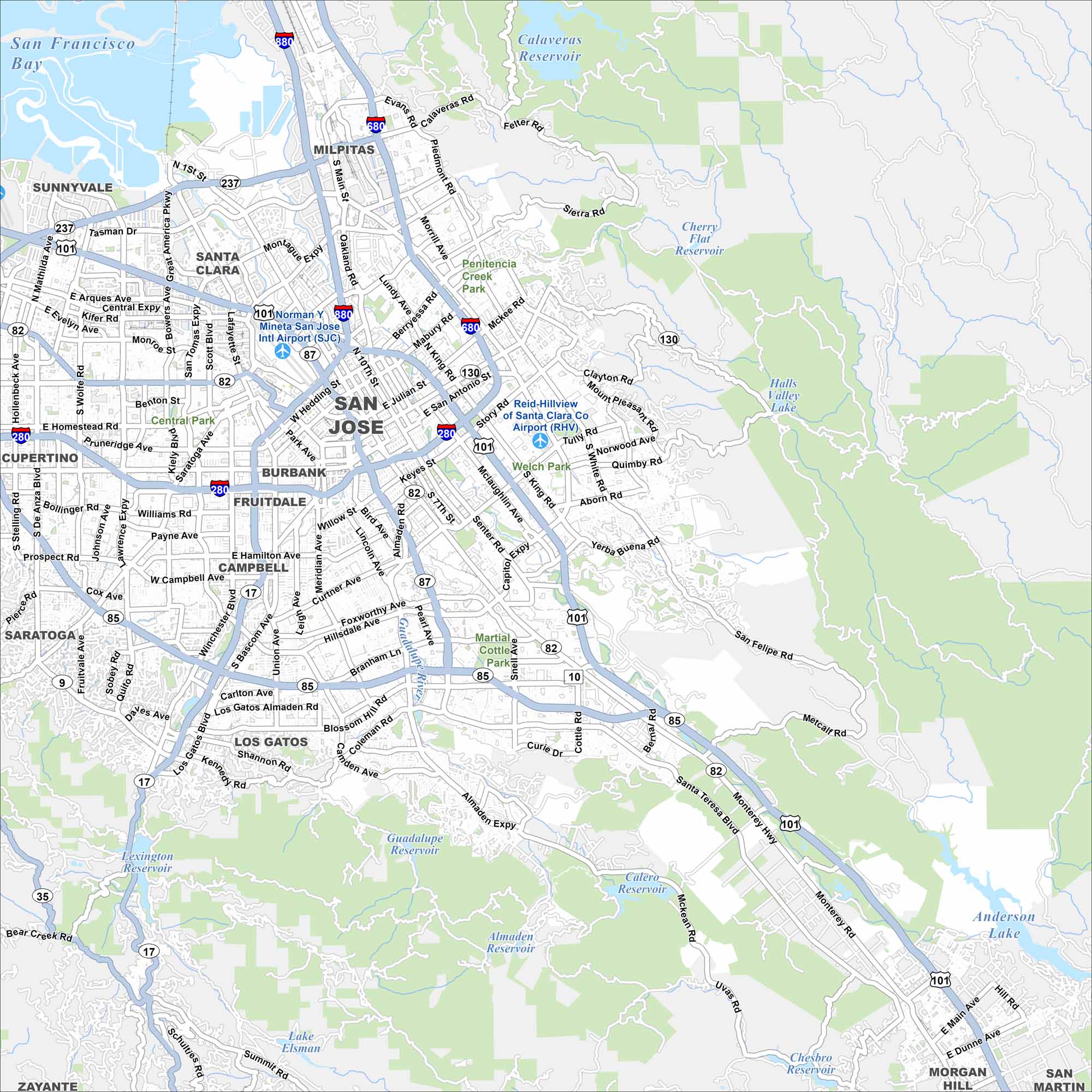
Our map of San Jose shows the heart of Silicon Valley. It guides you through downtown, neighborhoods, and parks. Use it to get your bearings.
California State Maps
Explore California with our state maps


Map Information
On the Map
Interstates/Highways: I-280, I-680, I-880, US Hwy 101, State Rte 82, State Rte 85, State Rte 87, State Rte 17, State Rte 237, State Rte 130 Major Roads: Monterey Hwy, Capitol Expy, San Tomas Expy, Lawrence Expy, Almaden Expy, Stevens Creek Blvd, Bascom Ave, Winchester Blvd, Tully Rd, White Rd, Story Rd, Berryessa Rd, McKee Rd, Piedmont Rd, Branham Ln, Blossom Hill Rd, Alum Rock Ave, Julian St, Market St, 1st St Airports: Mineta San Jose Intl Airport (SJC), Reid-Hillview of Santa Clara Co Airport (RHV) Lakes and Reservoirs: San Francisco Bay, Calaveras Reservoir, Almaden Reservoir, Calero Reservoir, Guadalupe Reservoir, Lexington Reservoir, Anderson Lake, Cherry Flat Reservoir, Lake Elsman Parks and Preserves: Martial Cottle Park, Welch Park, Central Park Nearby Communities: Santa Clara, Milpitas, Sunnyvale, Cupertino, Campbell, Los Gatos, Saratoga, Burbank, Fruitdale, Morgan Hill, San Martin Neighborhoods: Downtown San JoseCalifornia City Maps
Here are detailed maps of California


