Map of San Jacinto, California
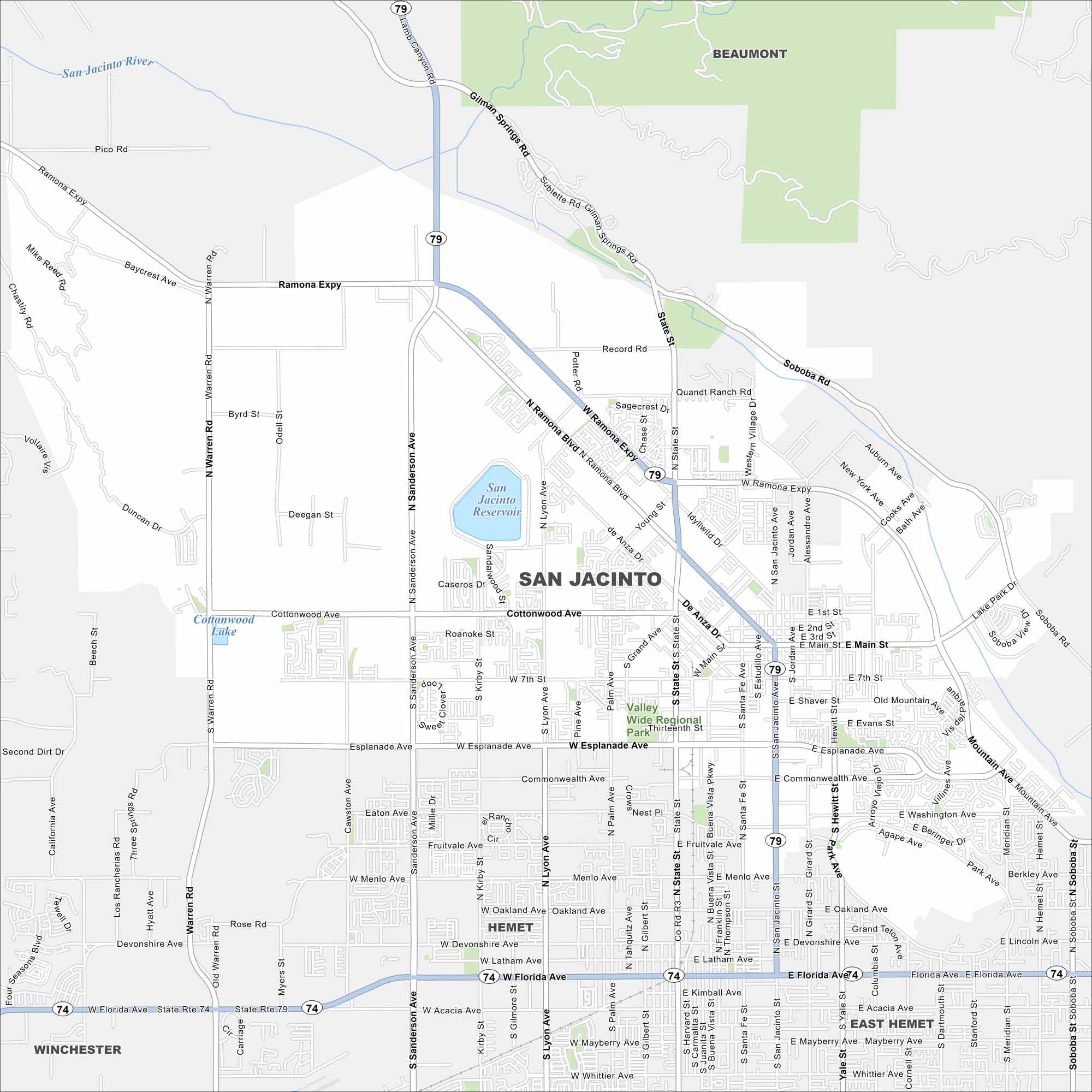
Our map of San Jacinto highlights its neighborhoods and routes across the valley. It’s a growing inland city with wide open views. Mount San Jacinto is not that far away either to the east.
California State Maps
Explore California with our state maps


Map Information
On the Map
Interstates/Highways: State Rte 79, State Rte 74 Major Roads: Ramona Expy, San Jacinto Ave, Sanderson Ave, Florida Ave, State St, Cottonwood Ave, Esplanade Ave, Main St, Lyon Ave, Warren Rd, Menlo Ave, Oakland Ave, Devonshire Ave, Latham Ave, Soboba Rd, Record Rd, Gilman Springs Rd, Commonwealth Ave, Seventh St, Hewitt St Lakes and Reservoirs: San Jacinto Reservoir, Cottonwood Lake Major Rivers: San Jacinto River Parks and Preserves: Valley Wide Regional Park Nearby Communities: Hemet, East Hemet, Beaumont, WinchesterCalifornia City Maps
Here are detailed maps of California


