Map of San Dimas, California
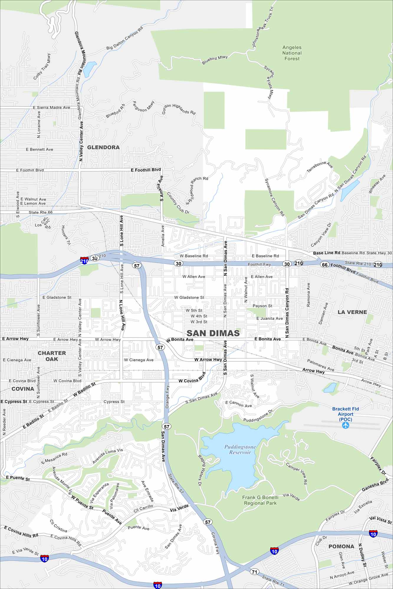
Here’s our map of San Dimas, California. You’ll find quiet neighborhoods, foothill parks, and Puddingstone Reservoir. It’s a community that blends suburbs and recreation.
California State Maps
Explore California with our state maps


Map Information
On the Map
Interstates/Highways: State Rte 210, State Rte 57, State Rte 71, State Rte 66, State Rte 30, I-10 Major Roads: San Dimas Ave, Bonita Ave, Arrow Hwy, Gladstone St, Baseline Rd, Foothill Blvd, San Dimas Canyon Rd, Badillo St, Covina Blvd, Cypress St, Puente Ave, Via Verde, Ganesha Blvd, Valley Center Ave, Lone Hill Ave, Amelia Ave, Walnut Ave, Allen Ave, Juanita Ave, Payson St Airports: Brackett Fld Airport (POC) Lakes and Reservoirs: Puddingstone Reservoir Parks and Preserves: Angeles National Forest, Frank G Bonelli Regional Park Nearby Communities: Glendora, La Verne, Covina, Charter Oak, PomonaCalifornia City Maps
Here are detailed maps of California


