Map of San Clemente, California
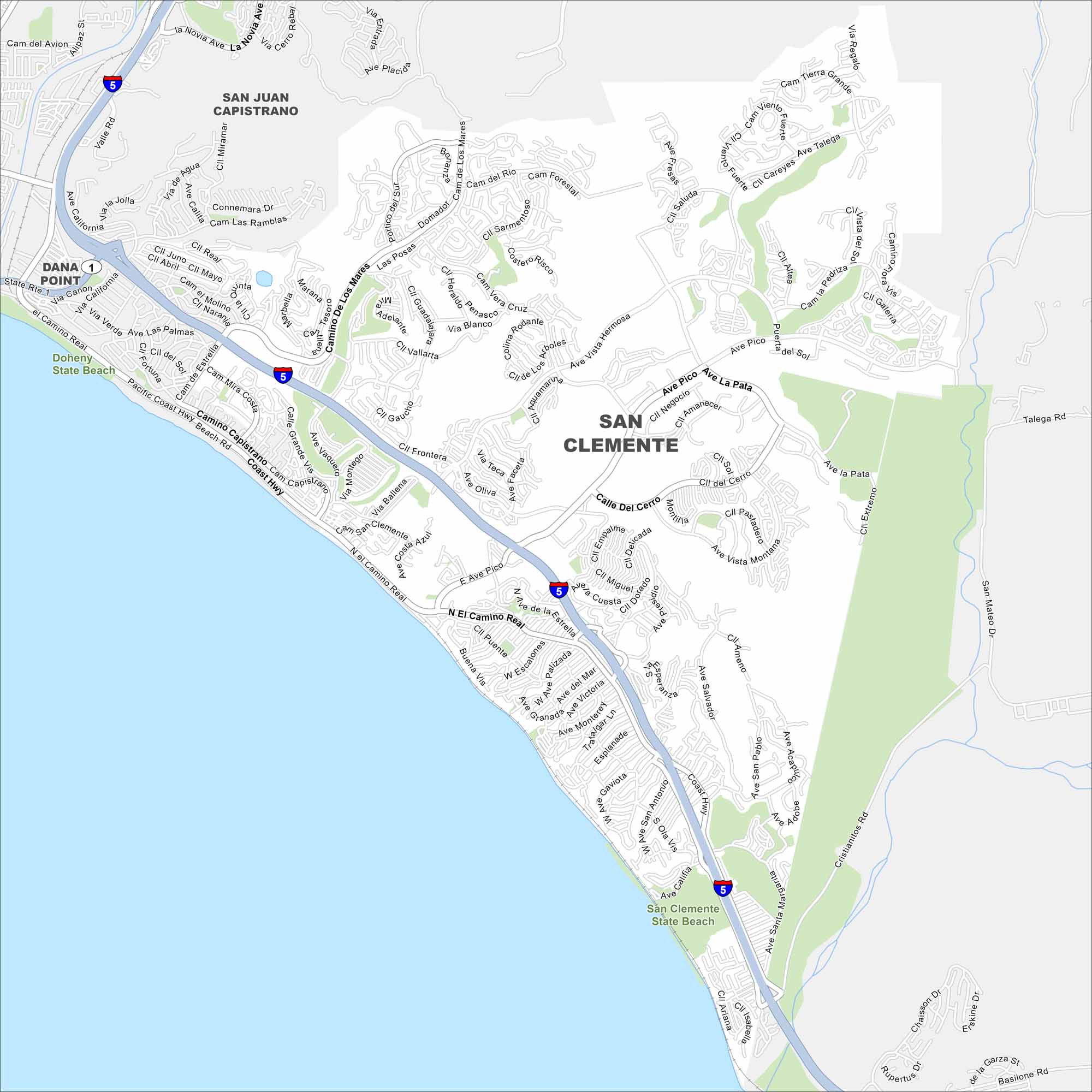
Take a look at our map of San Clemente. The pier and beach trails stand out right away. It’s a Southern California surf town worth a stop.
California State Maps
Explore California with our state maps


Map Information
On the Map
Interstates/Highways: I-5, State Rte 1 Major Roads: El Camino Real, Avenida Pico, Calle Del Cerro, Camino De Los Mares, Camino Capistrano, Pacific Coast Hwy, Avenida La Pata, Avenida Vista Hermosa, Avenida Vaquero, Calle Grande Vista, Camino Vera Cruz, Calle De La Estrella, Avenida San Antonio, Avenida Calafia, Cristianitos Rd, Avenida Salvador, Avenida Talega, Avenida Del Mar, Avenida Victoria, El Portal Lakes and Reservoirs: Pacific Ocean Parks and Preserves: San Clemente State Beach, Doheny State Beach Nearby Communities: San Juan Capistrano, Dana PointCalifornia City Maps
Here are detailed maps of California


