Map of San Carlos, California
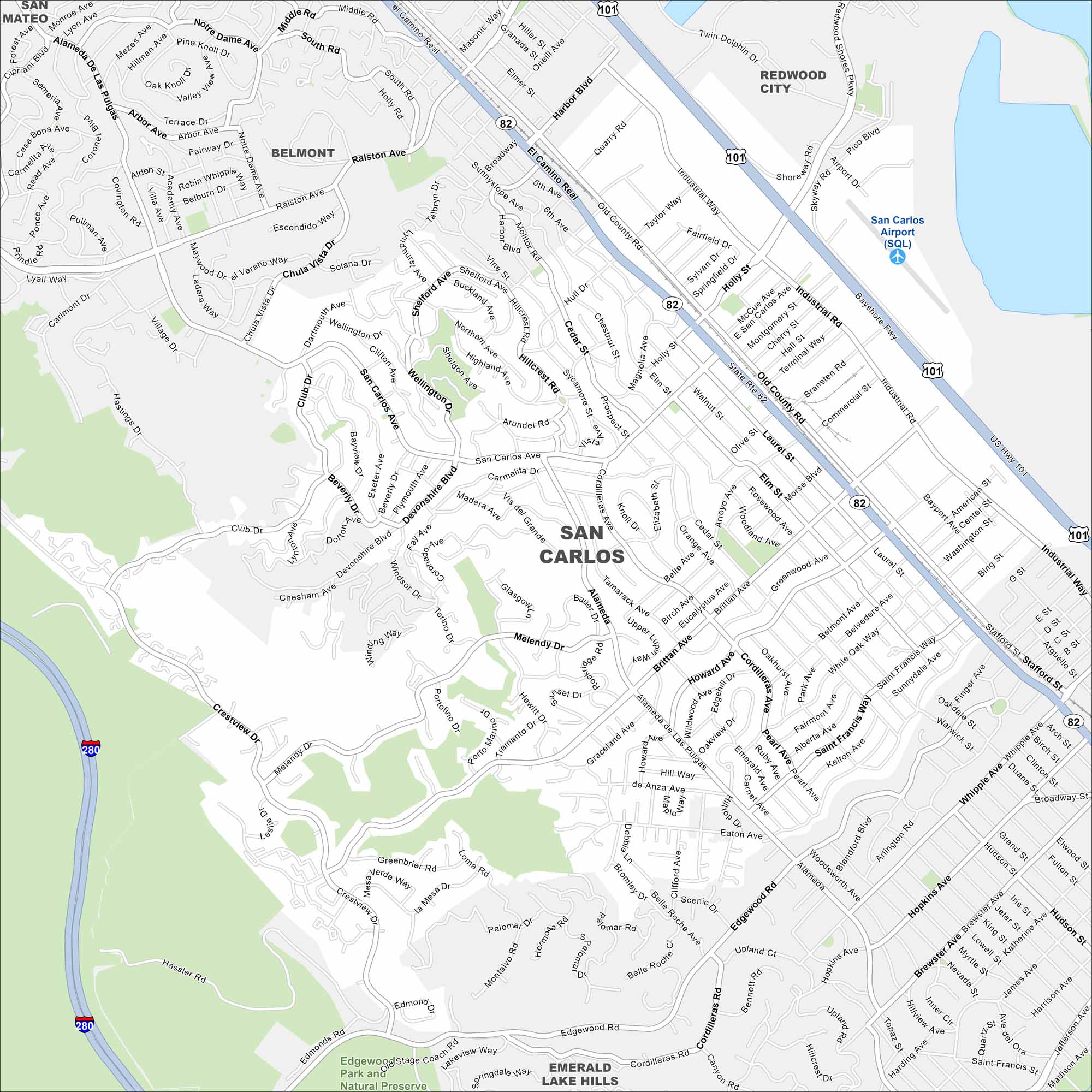
Our map of San Carlos helps you find your way through this Peninsula town. The main street is lively with shops and cafes. It’s a community with a relaxed, small-city feel.
California State Maps
Explore California with our state maps


Map Information
On the Map
Interstates/Highways: US Hwy 101, I-280, State Rte 82 Major Roads: El Camino Real, San Carlos Ave, Holly St, Industrial Rd, Old County Rd, Brittan Ave, Whipple Ave, Alameda De Las Pulgas, Crestview Dr, Laurel St, Cedar St, Eaton Ave, Edgewood Rd, Club Dr, Ralston Ave, Shoreway Rd, Skyway Rd, Redwood Shores Pkwy, Cordilleras Rd, Melendy Dr Airports: San Carlos Airport (SQL) Parks and Preserves: Edgewood Stage Coach Rd Park and Natural Preserve, Emerald Lake Hills Nearby Communities: Belmont, Redwood City, San MateoCalifornia City Maps
Here are detailed maps of California


