Map of San Buenaventura (Ventura), California
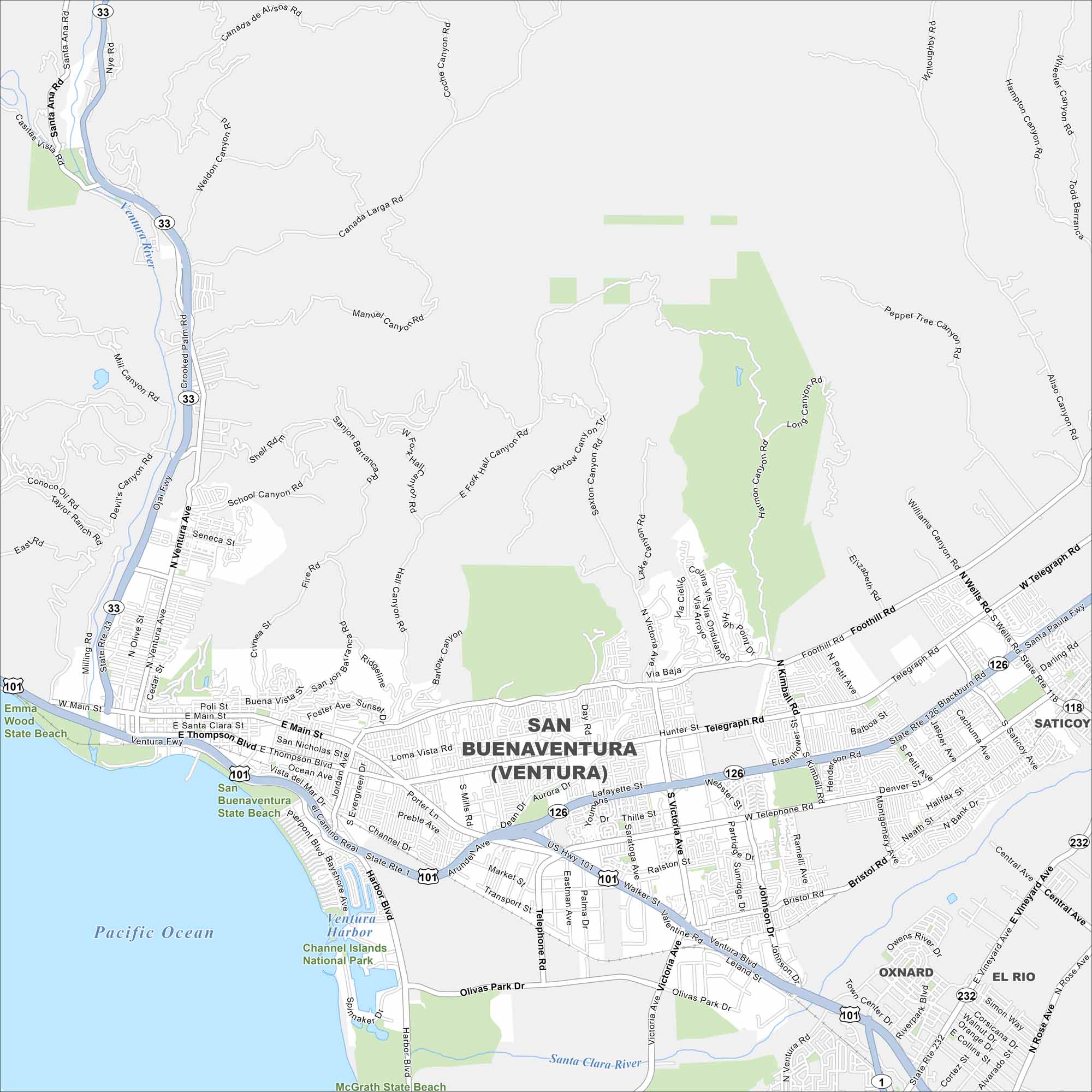
Here’s our map of Ventura, California. You’ll see the pier, the beaches, and the historic downtown. It’s a classic California coastal town with plenty to explore.
California State Maps
Explore California with our state maps


Map Information
On the Map
Interstates/Highways: US Hwy 101, State Rte 126, State Rte 33, State Rte 118, State Rte 232 Major Roads: Main St, Thompson Blvd, Harbor Blvd, Victoria Ave, Telegraph Rd, Foothill Rd, Seaward Ave, Telephone Rd, Wells Rd, Bristol Rd, Moon Dr, Olivas Park Dr, Mills Rd, Poli St, Santa Clara St, Ventura Ave, Vineyard Ave, Central Ave, Rose Ave, Saviers Rd Major Rivers: Ventura Harbor, Santa Clara River Parks and Preserves: Channel Islands National Park, Emma Wood State Beach, San Buenaventura State Beach, McGrath State Beach Nearby Communities: Oxnard, Saticoy, El RioCalifornia City Maps
Here are detailed maps of California


