Map of Rocklin, California
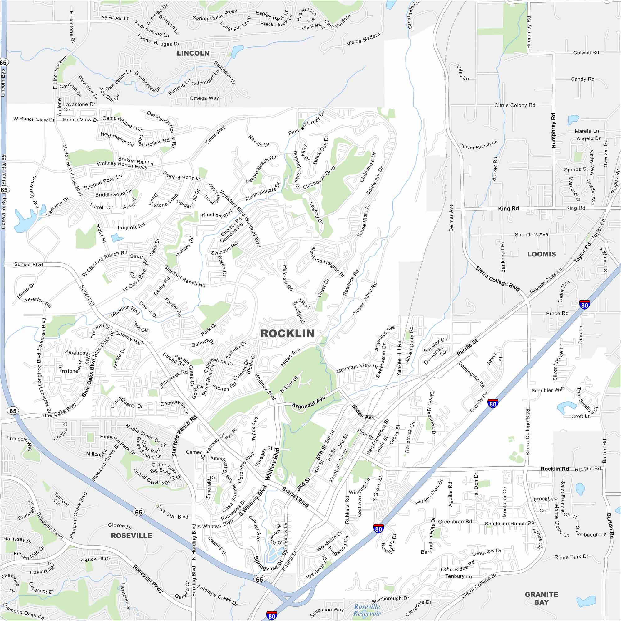
Our map of Rocklin highlights local neighborhoods, schools, and parks. You’ll see exactly how the city is connected and all the main routes into Sacramento.
California State Maps
Explore California with our state maps


Map Information
On the Map
Interstates/Highways: I-80, State Rte 65 Major Roads: Rocklin Rd, Sierra College Blvd, Pacific St, Sunset Blvd, Stanford Ranch Rd, Blue Oaks Blvd, Park Dr, Whitney Blvd, Lonetree Blvd, West Oaks Blvd, Wildcat Blvd, University Ave, Industrial Ave, Granite Dr, Midas Ave, Argonaut Ave, Taylor Rd, Pleasant Grove Blvd, Victory Dr, Roseville Pkwy Lakes and Reservoirs: Roseville Reservoir Nearby Communities: Lincoln, Roseville, Loomis, Granite Bay, Citrus Heights, Antelope, ElvertaCalifornia City Maps
Here are detailed maps of California


