Map of Riverside, California
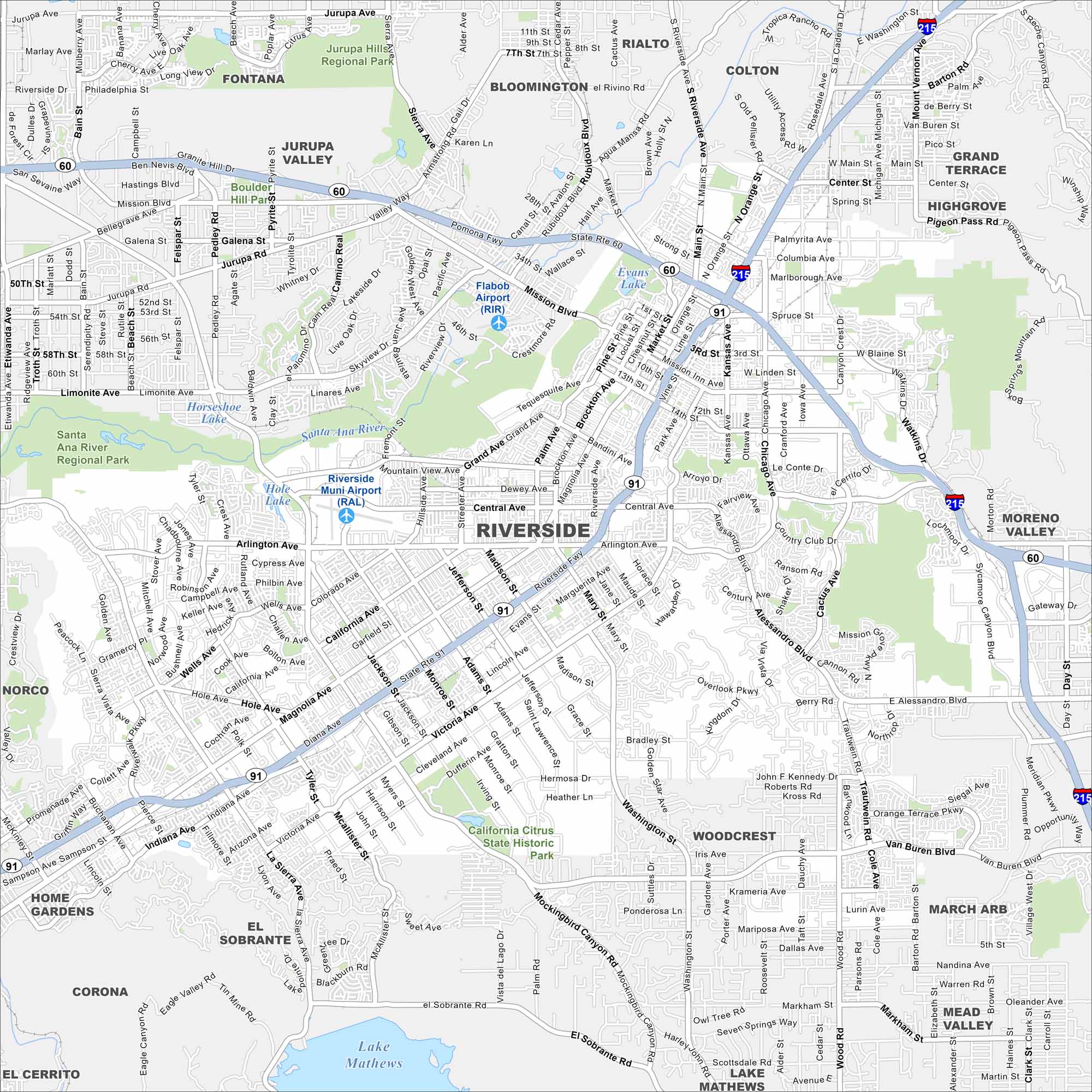
We’ve mapped out Riverside, California. It includes the downtown area, residential areas, and the nearby hills. The city’s layout is compact with the Santa Ana River running through it.
California State Maps
Explore California with our state maps


Map Information
On the Map
Interstates/Highways: I-215, State Rte 60, State Rte 91 Major Roads: Magnolia Ave, Van Buren Blvd, Central Ave, Arlington Ave, Victoria Ave, Alessandro Blvd, La Sierra Ave, Riverside Ave, Market St, Mission Inn Ave, Main St, Brockton Ave, Jurupa Ave, Washington St, Wood Rd, Chicago Ave, Mary St, Adams St, Madison St, Indiana Ave Airports: Riverside Muni Airport (RAL), Flabob Airport (RIR), March Arb Lakes and Reservoirs: Evans Lake, Hole Lake, Lake Mathews Major Rivers: Santa Ana River Parks and Preserves: California Citrus State Historic Park, Jurupa Hills Regional Park, Santa Ana River Regional Park Nearby Communities: Fontana, Rialto, Colton, Bloomington, Jurupa Valley, Grand Terrace, Highgrove, Moreno Valley, Woodcrest, Mead Valley, El Sobrante, Home Gardens, Corona, Norco, El CerritoCalifornia City Maps
Here are detailed maps of California


