Map of Rio Vista, California
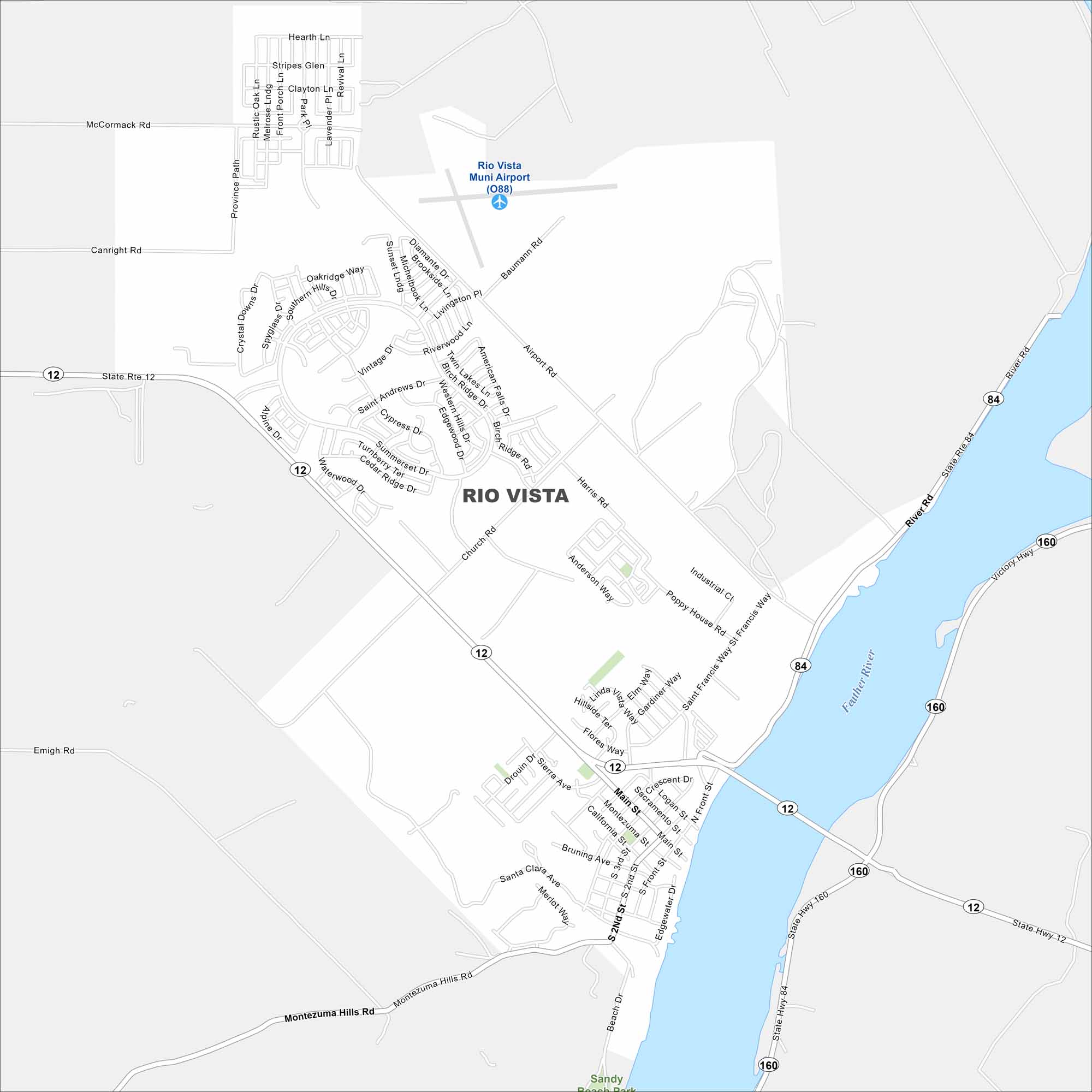
Get to know Rio Vista, which sits along the Sacramento River. Bridges and main streets stand out. You’ll also find small parks and its airport in our Rio Vista map.
California State Maps
Explore California with our state maps


Map Information
On the Map
Interstates/Highways: State Rte 12, State Rte 84, State Hwy 160 Major Roads: Main St, Airport Rd, Montezuma Hills Rd, River Rd, Church Rd, Front St, 2nd St, Poppy House Rd, Drouin Dr, California St, Sierra Ave, Montezuma St, Sacramento St, Logan St, Beach Dr, Edgewater Dr, Bruning Ave, Hillside Ter, Flores Way, Linda Vista Way Airports: Rio Vista Muni Airport (O88) Major Rivers: Sacramento River Nearby Communities: Sandy Beach ParkCalifornia City Maps
Here are detailed maps of California


