Map of Redwood City, California
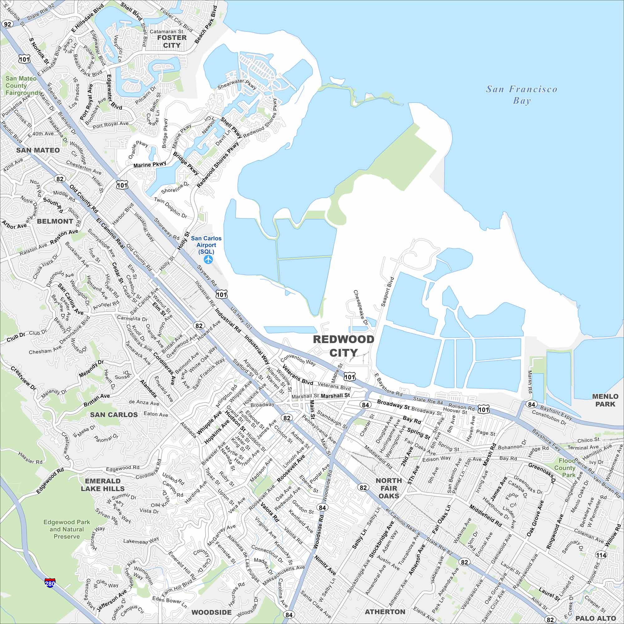
Located on the San Francisco Peninsula, Redwood City has a lively downtown and a strong tech presence. Our road map shows its waterfront and connections across the Bay Area.
California State Maps
Explore California with our state maps


Map Information
On the Map
Interstates/Highways: US Hwy 101, State Rte 82, State Rte 84, State Rte 92, I-280 Major Roads: El Camino Real, Woodside Rd, Broadway, Veterans Blvd, Whipple Ave, Industrial Way, Jefferson Ave, Edgewood Rd, Farm Hill Blvd, Middlefield Rd, Marsh Rd, Bay Rd, Seaport Blvd, Redwood Shores Pkwy, Marine Pkwy, Holly St, Ralston Ave, Alamada de las Pulgas, Valota Rd, Roosevelt Ave Airports: San Carlos Airport (SQL) Lakes and Reservoirs: San Francisco Bay Parks and Preserves: Edgewood Park and Natural Preserve Nearby Communities: Redwood City, San Mateo, Foster City, Belmont, San Carlos, Emerald Lake Hills, Woodside, North Fair Oaks, Atherton, Menlo Park, Palo AltoCalifornia City Maps
Here are detailed maps of California


