Map of Redding, California
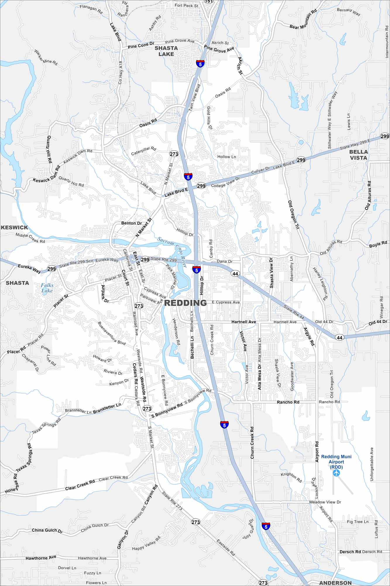
Redding is the largest city in far Northern California. One reason is because access to Shasta Lake make it a popular gateway for outdoor adventure. Our road map shows the main highways and rivers that connect it all.
California State Maps
Explore California with our state maps


Map Information
On the Map
Interstates/Highways: I-5, State Rte 299, State Rte 44, State Rte 273 Major Roads: Cypress Ave, Hilltop Dr, Market St, Churn Creek Rd, Victor Ave, Lake Blvd, Oasis Rd, Hartnell Ave, Airport Rd, Bechelli Ln, Placer St, Eureka Way, Bonnyview Rd, Canyon Rd, Clear Creek Rd, Westside Rd, Quartz Hill Rd, Keswick Dam Rd, Old Alturas Rd, Knighton Rd Airports: Redding Muni Airport (RDD) Lakes and Reservoirs: Falks Lake Major Rivers: Sacramento River Nearby Communities: Redding, Shasta, Keswick, Bella Vista, AndersonCalifornia City Maps
Here are detailed maps of California


