Map of Red Bluff, California
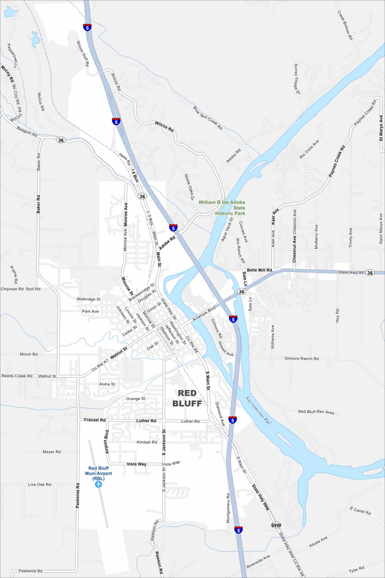
This Northern California town lies along the Sacramento River. The city once served as a busy port during the Gold Rush era. Our map of Red Bluff shows the grid of streets and the routes leading into the surrounding countryside.
California State Maps
Explore California with our state maps


Map Information
On the Map
Interstates/Highways: I-5, State Hwy 99, State Hwy 36, US Hwy 99W Major Roads: Main St, Antelope Blvd, Walnut St, Adobe Rd, Monroe Ave, Paskenta Rd, Wilcox Rd, Sale Ln, Williams Ave, Baker Rd, Montgomery Rd, Gilmore Rd, Hook Rd, Orange St, Luther Rd, Airport Blvd, Jackson St, Vista Way, McCoy Rd, Beegum Rd Airports: Red Bluff Muni Airport (RBL) Major Rivers: Sacramento River Parks and Preserves: William B Ide Adobe State Historic Park, Red Bluff Rec Area Nearby Communities: Red BluffCalifornia City Maps
Here are detailed maps of California


