Map of Rancho Santa Margarita, California
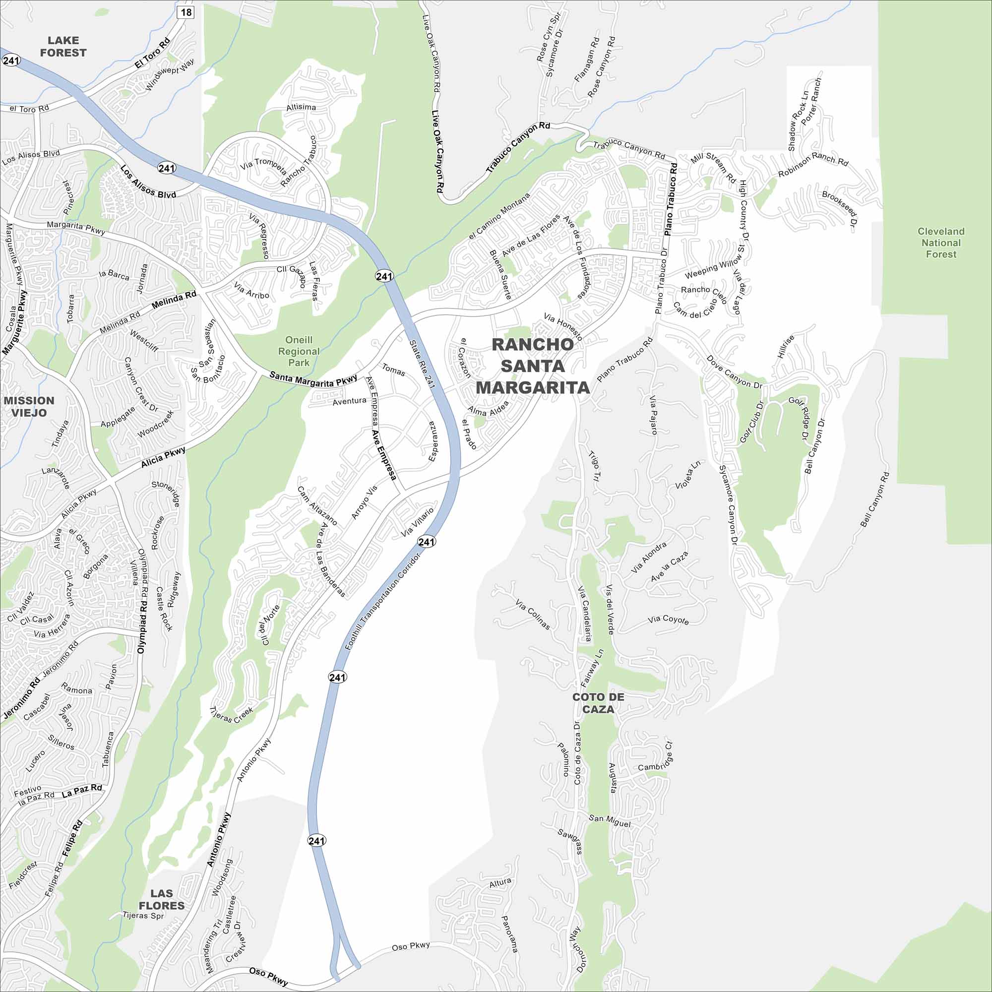
Learn about this master-planned community in Orange County by using our map of Rancho Santa Margarita. It’s surrounded by foothills and centers around Rancho Santa Margarita Lake, a popular gathering spot.
California State Maps
Explore California with our state maps


Map Information
On the Map
Interstates/Highways: State Rte 241 Major Roads: Santa Margarita Pkwy, Antonio Pkwy, Plano Trabuco Rd, El Toro Rd, Alicia Pkwy, Los Alisos Blvd, Oso Pkwy, Melinda Rd, Empressa, Trabuco Canyon Rd, Live Oak Canyon Rd, Marguerite Pkwy, Olympiad Rd, Jeronimo Rd, Felipe Rd, Banderas, Ave De Las Flores, Alma Aldea, Meandering Trl, Dove Canyon Dr Parks and Preserves: Cleveland National Forest, O’Neill Regional Park Nearby Communities: Lake Forest, Mission Viejo, Coto De Caza, Las FloresCalifornia City Maps
Here are detailed maps of California


