Map of Poway, California
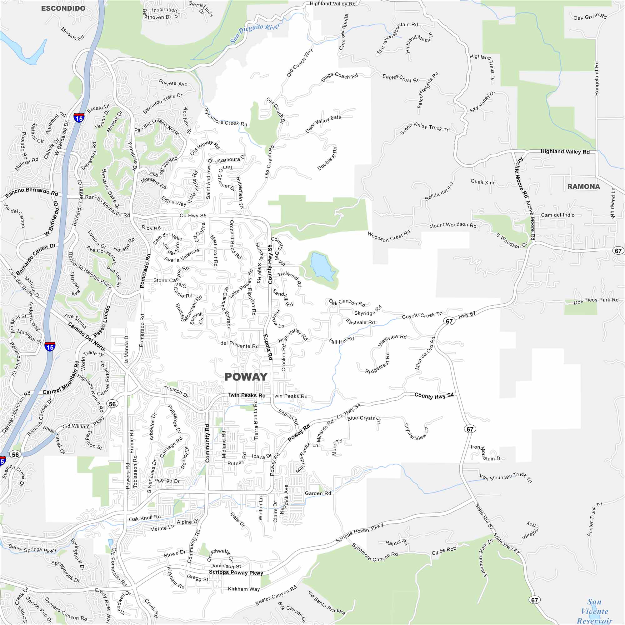
Poway lies northeast of San Diego, surrounded by hills and canyons. Reservoirs and open space are scattered throughout the city. It’s often called the “City in the Country” because of its blend of suburban and rural areas.
California State Maps
Explore California with our state maps


Map Information
On the Map
Interstates/Highways: State Rte 67 Major Roads: Pomerado Rd, Poway Rd, Espola Rd, Community Rd, Scripps Poway Pkwy, Twin Peaks Rd, Rancho Bernardo Rd, Midland Rd, Garden Rd, Beeler Canyon Rd, Highland Valley Rd, Ted Williams Pkwy, Kirkham Rd, Camino Del Norte, Sycamore Canyon Rd, High Valley Rd, Mount Woodson Rd, Old Coach Rd, Valle Verde Rd, Blue Crystal Lakes and Reservoirs: San Vicente Reservoir Major Rivers: San Dieguito River Nearby Communities: Escondido, Ramona, Rancho Bernardo, Sabre SpringsCalifornia City Maps
Here are detailed maps of California


