Map of Pleasant Hill, California
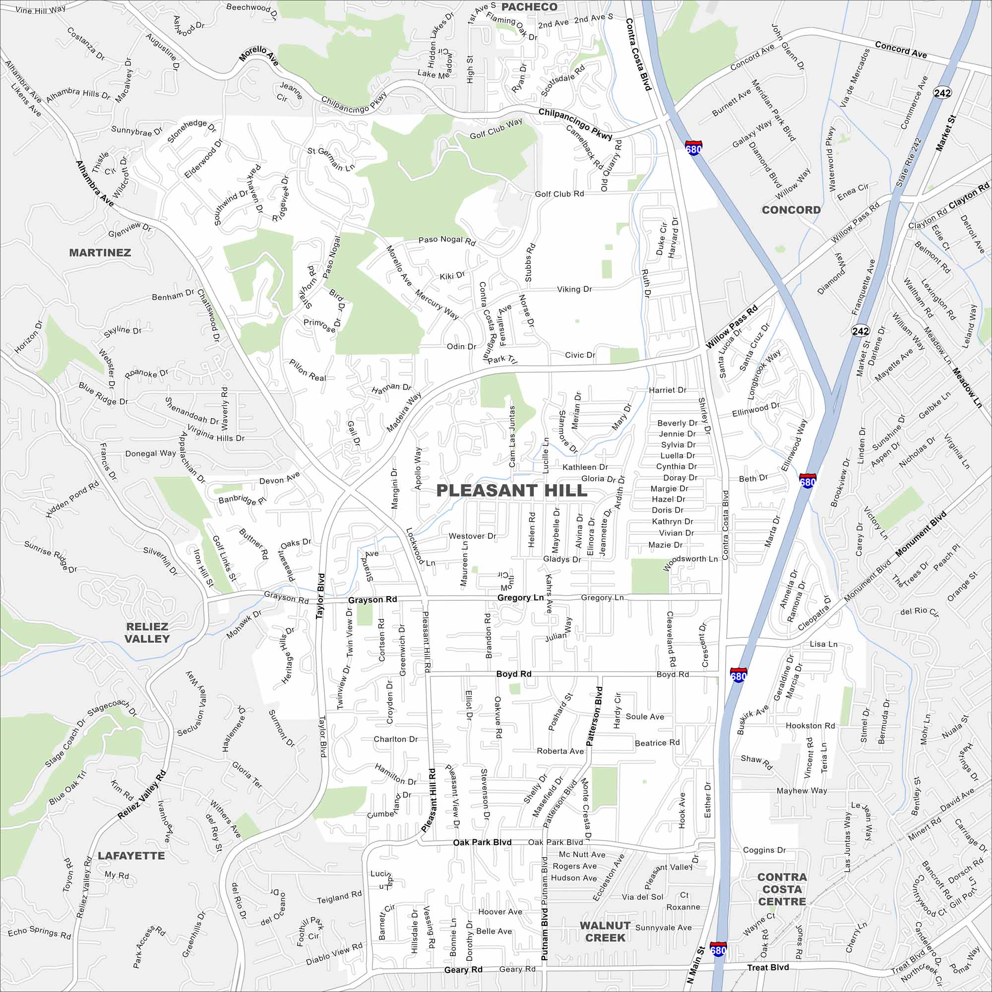
Our map of Pleasant Hill shows its suburban grid tucked between Concord and Walnut Creek. Parks and open spaces are scattered through the neighborhoods. The Contra Costa Canal Trail runs right through town.
California State Maps
Explore California with our state maps


Map Information
On the Map
Interstates/Highways: I-680, State Rte 242 Major Roads: Contra Costa Blvd, Gregory Ln, Taylor Blvd, Pleasant Hill Rd, Monument Blvd, Boyd Rd, Oak Park Blvd, Geary Rd, Grayson Rd, Chilpancingo Pkwy, Golf Club Way, Viking Dr, Civic Dr, Morello Ave, Virginia Hills Dr, Sunneydale Ave, Buskirk Ave, Hookston Rd, Treat Blvd, Patterson Blvd Nearby Communities: Pacheco, Concord, Martinez, Reliez Valley, Lafayette, Walnut Creek, Contra Costa CentreCalifornia City Maps
Here are detailed maps of California


