Map of Placerville, California
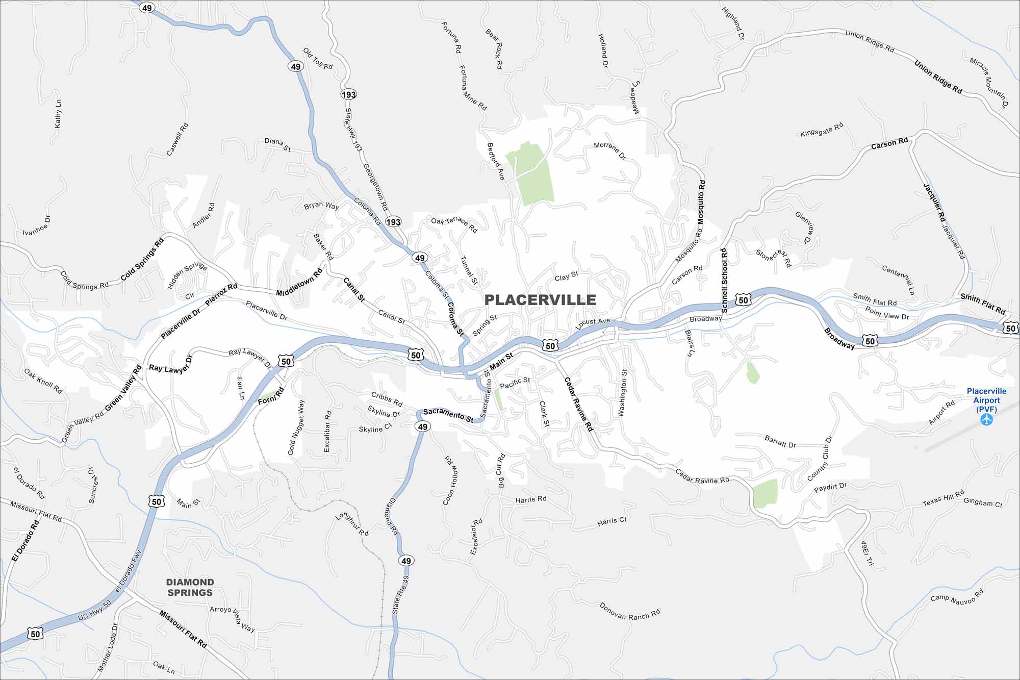
Placerville rests in the Sierra Nevada foothills, once central to the Gold Rush. Our map shows the winding streets climbing the hills. Historic buildings line its small downtown core.
California State Maps
Explore California with our state maps


Map Information
On the Map
Interstates/Highways: US Hwy 50, State Rte 49, State Rte 193 Major Roads: Main St, Broadway, Placerville Dr, Canal St, Coloma St, Cedar Ravine Rd, Forni Rd, Middletown Rd, Cold Springs Rd, Green Valley Rd, Mosquito Rd, Schnell School Rd, Smith Flat Rd, Texas Hill Rd, Union Ridge Rd, Carson Rd, Jacquier Rd, Point View Dr, Barrett Dr, Harris Rd Airports: Placerville Airport (PVF) Nearby Communities: Diamond SpringsCalifornia City Maps
Here are detailed maps of California


