Map of Pittsburg, California
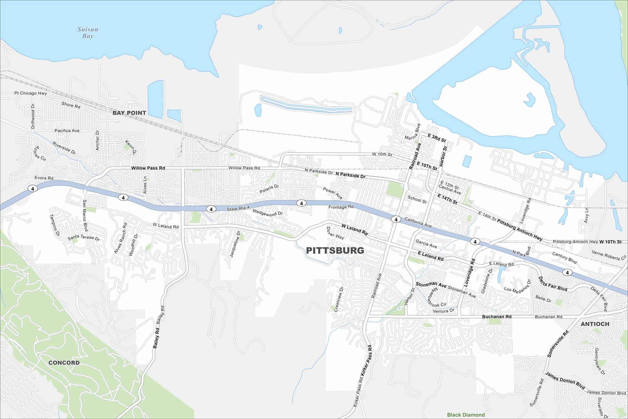
Pittsburg sits on the southern edge of Suisun Bay in the East Bay. Check out our map to see its waterfront, neighborhoods, and highway links. The city has a strong industrial and shipping history.
California State Maps
Explore California with our state maps


Map Information
On the Map
Interstates/Highways: State Rte 4 Major Roads: Railroad Ave, Willow Pass Rd, Leland Rd, Buchanan Rd, California Ave, Harbor St, Loveridge Rd, Pt Chicago Hwy, Delta Fair Blvd, James Donlon Blvd, Somersville Rd, School St, Power Ave, Frontage Rd, Bailey Rd, San Marco Blvd, Kirker Pass Rd, Garcia Ave, Century Blvd, Stoneman Ave Lakes and Reservoirs: Suisun Bay Nearby Communities: Bay Point, Antioch, Concord, Black DiamondCalifornia City Maps
Here are detailed maps of California


