Map of Pico Rivera, California
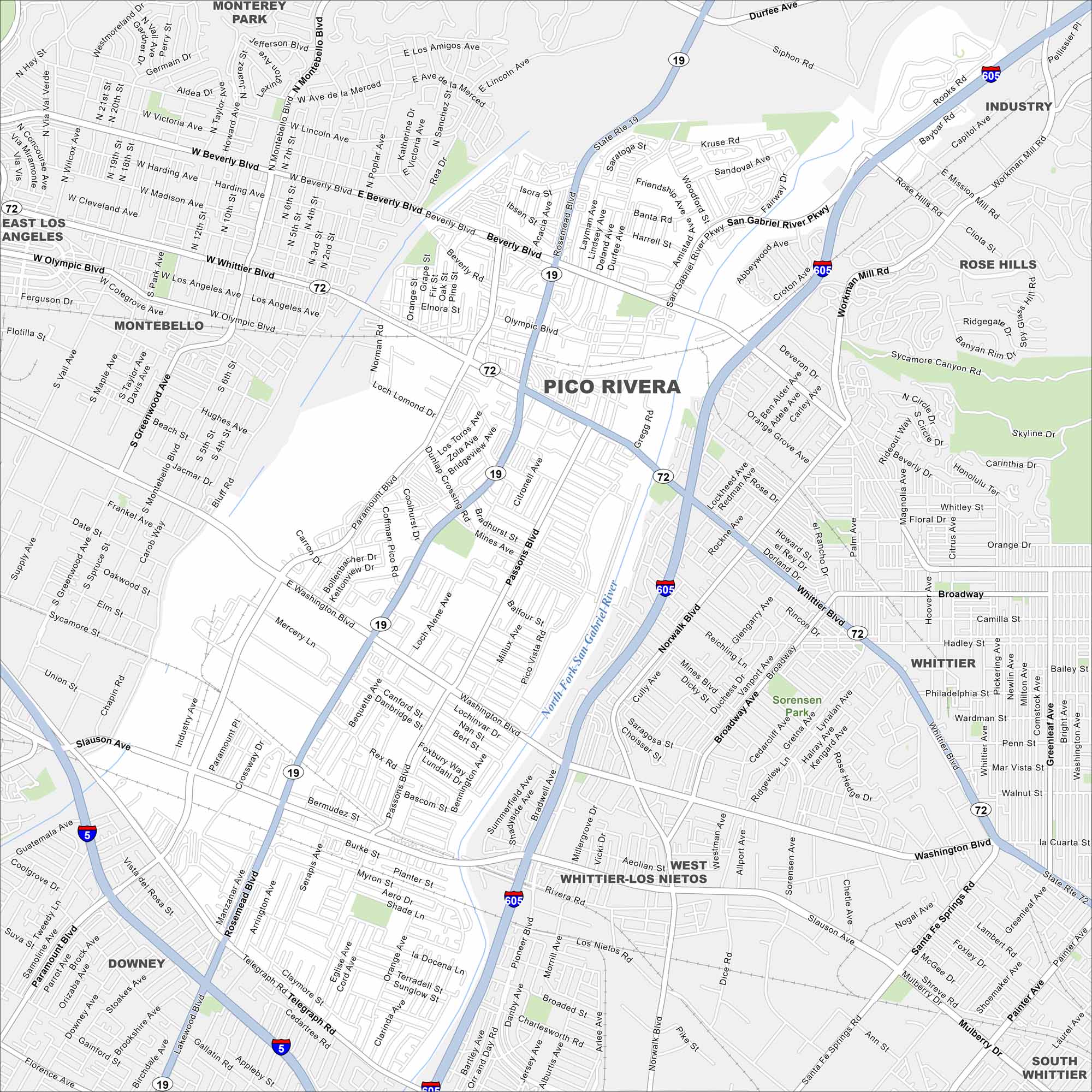
Our map of Pico Rivera lays out a suburban grid between Los Angeles and Whittier. Freeways cut across the city, linking neighborhoods. It’s a community shaped by both residential life and industry.
California State Maps
Explore California with our state maps


Map Information
On the Map
Interstates/Highways: I-605, I-5, State Rte 19 Major Roads: Whittier Blvd, Beverly Blvd, Washington Blvd, Rosemead Blvd, Paramount Blvd, Slauson Ave, Telegraph Rd, Passons Blvd, San Gabriel River Pkwy, Olympic Blvd, Montebello Blvd, Mines Blvd, Norwalk Blvd, Broadway, Gallatin Rd, Dunlap Crossing Rd, Loch Lomond Dr, Rivera Rd, Aeolian St, Kruse Rd Major Rivers: North Fork San Gabriel River, San Gabriel River Nearby Communities: Monterey Park, Industry, East Los Angeles, Montebello, Rose Hills, Whittier, West Whittier-Los Nietos, Downey, South WhittierCalifornia City Maps
Here are detailed maps of California


