Map of Paramount, California
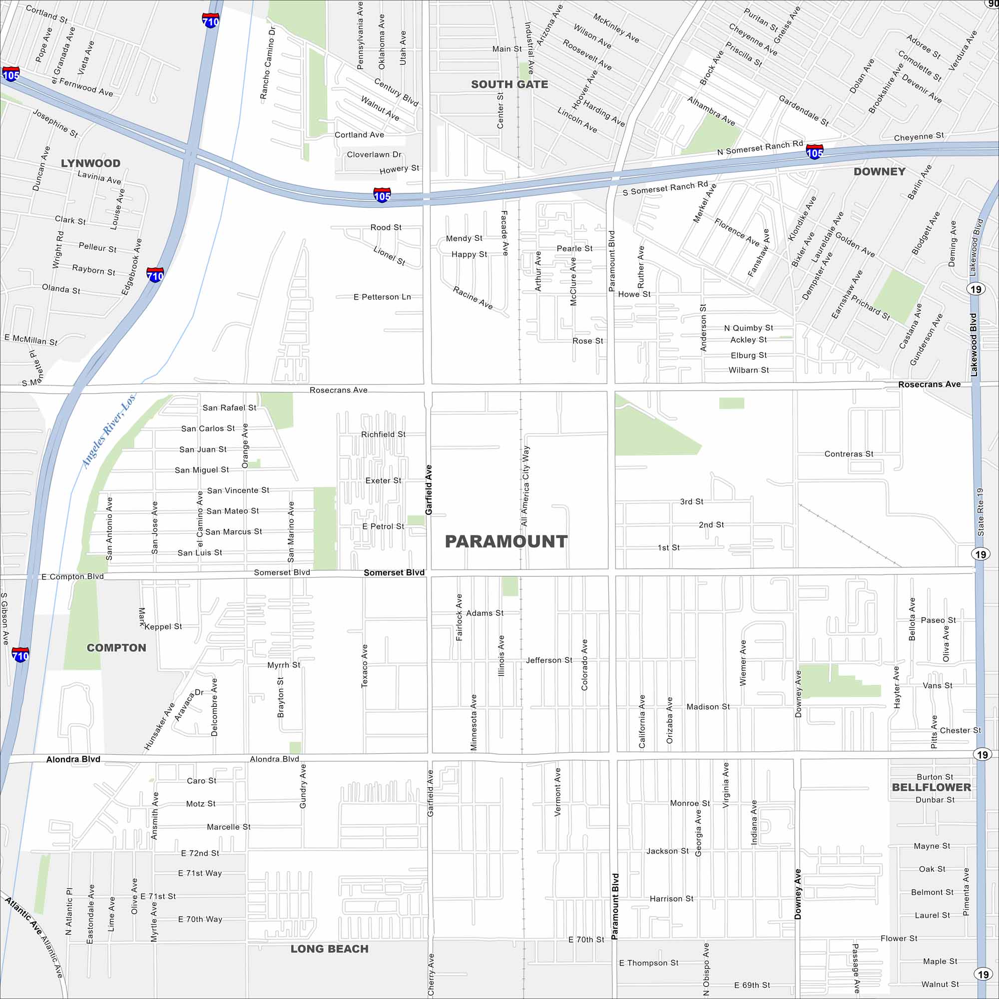
Our map of Paramount outlines a compact city in southeast Los Angeles County. The grid shows residential neighborhoods alongside busy commercial corridors.
California State Maps
Explore California with our state maps


Map Information
On the Map
Interstates/Highways: I-710, I-105, State Rte 19 Major Roads: Rosecrans Ave, Paramount Blvd, Alondra Blvd, Garfield Ave, Somerset Blvd, Downey Ave, Lakewood Blvd, Atlantic Ave, Hondo Ave, Century Blvd, Walnut Ave, Industrial Ave, Center St, Abbott Rd, Arthur Ave, Colorado Ave, California Ave, Indiana Ave, Georgia Ave, Flower St Major Rivers: Los Angeles River Nearby Communities: South Gate, Downey, Bellflower, Long Beach, Compton, LynwoodCalifornia City Maps
Here are detailed maps of California


