Map of Palm Desert, California
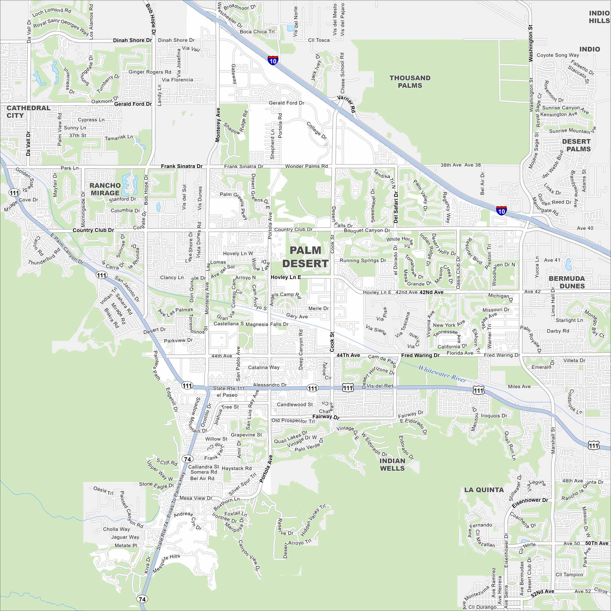
Our map of Palm Desert shows neighborhoods fanning across the Coachella Valley. Golf courses, resorts, and desert landscapes define the layout. The city sits close to the Santa Rosa Mountains.
California State Maps
Explore California with our state maps


Map Information
On the Map
Interstates/Highways: I-10, State Rte 111, State Rte 74 Major Roads: Monterey Ave, Cook St, Fred Waring Dr, Bob Hope Dr, Country Club Dr, Washington St, Frank Sinatra Rd, Dinah Shore Dr, Gerald Ford Dr, Portola Ave, Highway 111, Shadow Mountain Dr, Mesa View Dr, 38th Ave, 42nd Ave, 44th Ave, Deep Canyon Rd, San Pasqual Ave, Warner Trl, Miles Ave Major Rivers: Whitewater River Nearby Communities: Cathedral City, Rancho Mirage, Thousand Palms, Indio, Bermuda Dunes, Indian Wells, La QuintaCalifornia City Maps
Here are detailed maps of California


