Map of Oroville, California
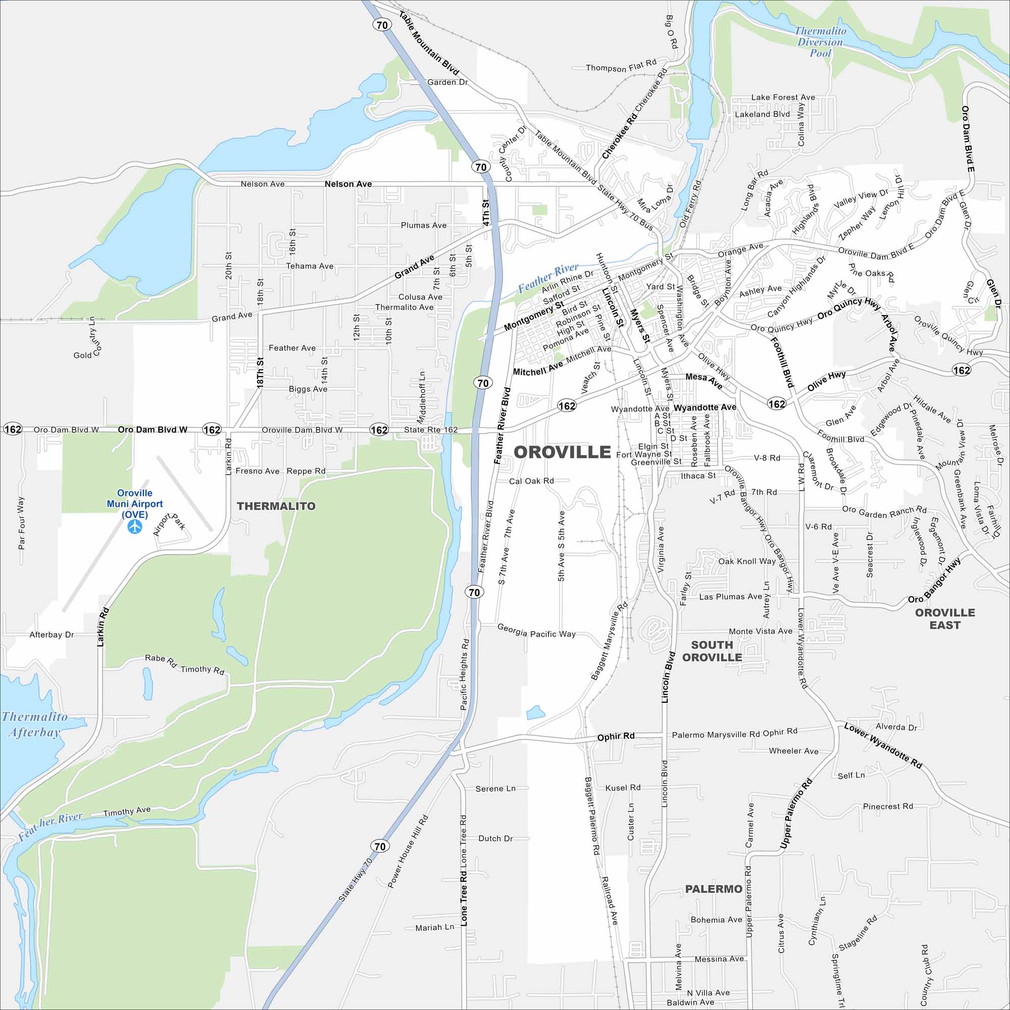
Our map of Oroville shows a city along the Feather River. The massive Oroville Dam and reservoir stand just to the east. The downtown sits at the heart of Butte County.
California State Maps
Explore California with our state maps


Map Information
On the Map
Interstates/Highways: State Rte 70, State Rte 162 Major Roads: Oro Dam Blvd W, Oro Dam Blvd E, Feather River Blvd, Olive Hwy, Table Mountain Blvd, Montgomery St, Nelson Ave, Grand Ave, Lincoln Blvd, Wyandotte Ave, Oro Quincy Hwy, Oro Bangor Hwy, Baggett Palermo Rd, Lower Wyandotte Rd, Upper Palermo Rd, Foothill Blvd, Larkin Rd, Main St, Mitchell Ave, 5th Ave Airports: Oroville Muni Airport (OVE) Lakes and Reservoirs: Thermalito Afterbay, Thermalito Diversion Pool Major Rivers: Feather River Nearby Communities: Thermalito, South Oroville, Oroville East, PalermoCalifornia City Maps
Here are detailed maps of California


