Map of Orange, California
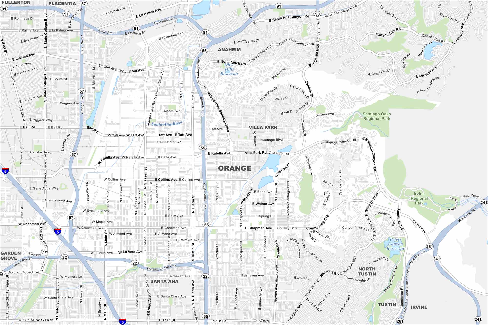
Our map of Orange highlights a city with a historic central plaza. Suburban neighborhoods stretch outward, linked by freeways. The city is also home to Chapman University.
California State Maps
Explore California with our state maps


Map Information
On the Map
Interstates/Highways: I-5, State Rte 57, State Rte 55, State Rte 22, State Rte 91, State Rte 241, State Rte 261, County Hwy S18 Major Roads: Katella Ave, Chapman Ave, Tustin Ave, Glassell St, Main St, Cannon St, Santiago Canyon Rd, Jamboree Rd, Ball Rd, Taft Ave, Collins Ave, Walnut Ave, La Veta Ave, Fairhaven Ave, Meats Ave, Imperial Hwy, Santiago Blvd, Villa Park Rd, Hewes St, Newport Blvd Lakes and Reservoirs: Olive Hills Reservoir, Peters Canyon Reservoir Major Rivers: Santa Ana River Parks and Preserves: Santiago Oaks Regional Park, Irvine Regional Park Nearby Communities: Anaheim, Villa Park, Santa Ana, Tustin, Garden Grove, North Tustin, Fullerton, PlacentiaCalifornia City Maps
Here are detailed maps of California


