Map of Oakland, California
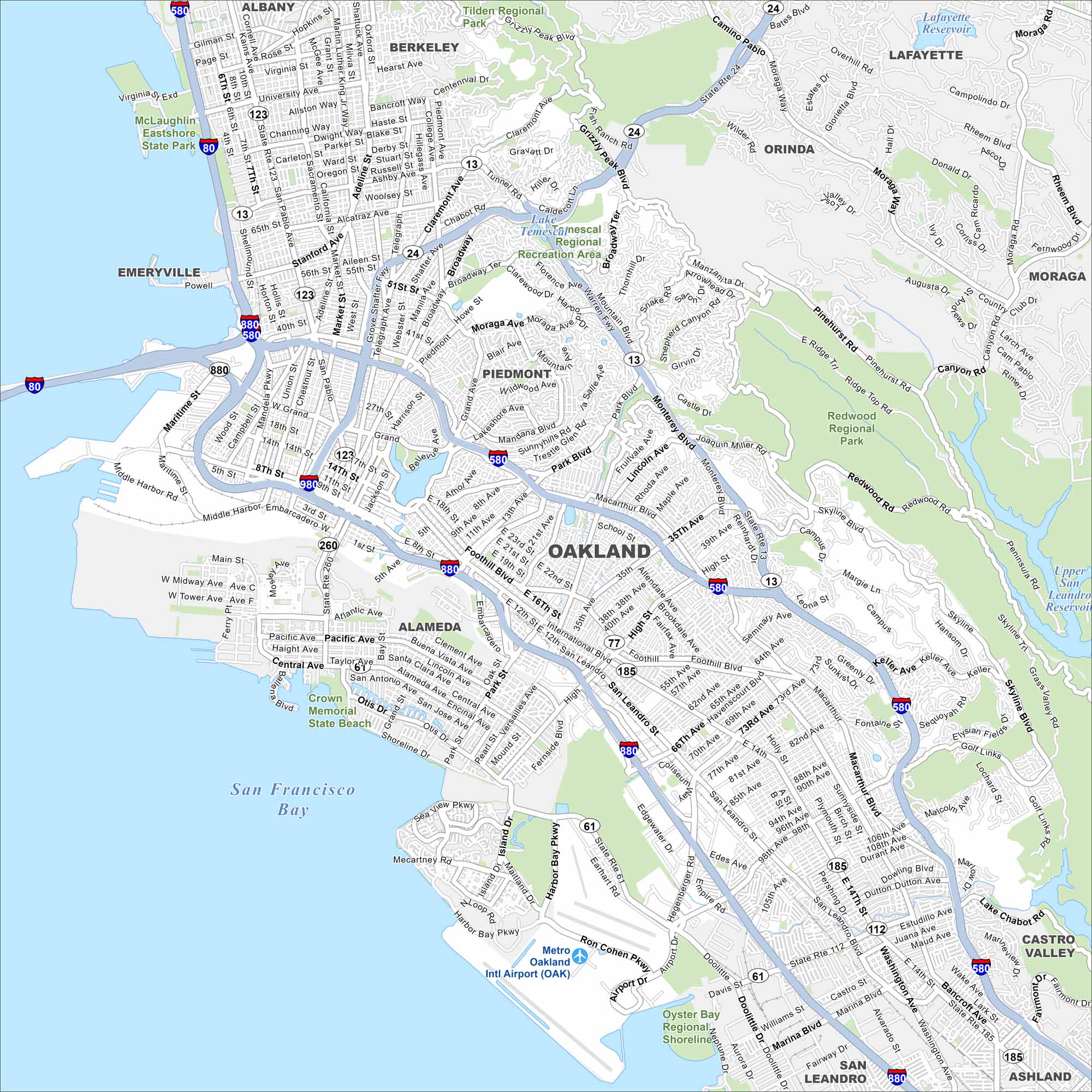
Our map of Oakland shows a city spread between the Bay shoreline and the East Bay Hills. The downtown core sits by Lake Merritt, with neighborhoods climbing the hillsides. The Port of Oakland dominates the waterfront.
California State Maps
Explore California with our state maps


Map Information
On the Map
Interstates/Highways: I-80, I-580, I-880, I-980, State Rte 13, State Rte 24, State Rte 61, State Rte 112, State Rte 123, State Rte 185, State Rte 260 Major Roads: Broadway, Grand Ave, Telegraph Ave, MacArthur Blvd, Foothill Blvd, San Leandro St, Hegenberger Rd, International Blvd, High St, 14th St, 73rd Ave, 98th Ave, Keller Ave, Skyline Blvd, Maritime St, West St, Harrison St, Park Blvd, Fruitvale Ave, 35th Ave Airports: Metro Oakland Intl Airport (OAK) Lakes and Reservoirs: San Francisco Bay, Lake Merritt, Lake Temescal, Lake Chabot, Upper San Leandro Reservoir, Lafayette Reservoir Parks and Preserves: Tilden Regional Park, Redwood Regional Park, McLaughlin Eastshore State Park, Crown Memorial State Beach, Oyster Bay Regional Shoreline Nearby Communities: Berkeley, Emeryville, Piedmont, Alameda, San Leandro, Orinda, Lafayette, Moraga, Castro ValleyCalifornia City Maps
Here are detailed maps of California


