Map of Oak Ridge, Tennessee
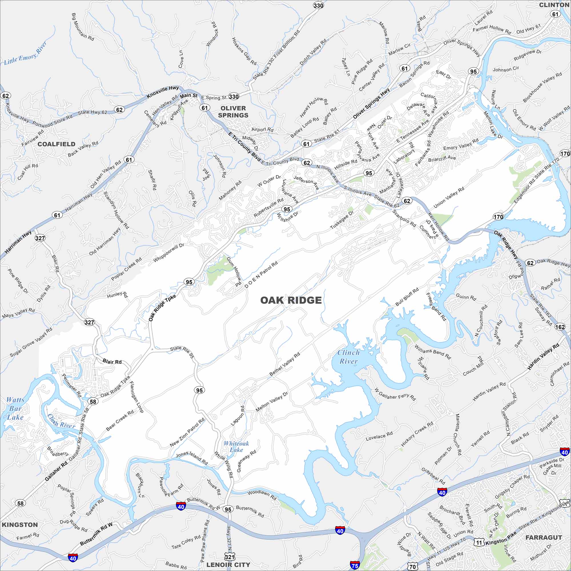
Oak Ridge is set in the valleys west of Knoxville. This map shows a spread of neighborhoods, rivers, and wooded ridges. The city is known for its role in the Manhattan Project.
Map Information
On the Map
Interstates/Highways: I-40, US Hwy 11, US Hwy 70, State Rte 1, State Rte 58, State Rte 61, State Rte 62, State Rte 75, State Rte 95, State Rte 162, State Rte 170, State Rte 321, State Rte 327, State Rte 330 Major Roads: Oak Ridge Hwy, Oak Ridge Tpke, Illinois Ave, Hardin Valley Rd, Kingston Pike, Bethel Valley Rd, Buttermilk Rd, Gallaher Rd, Oliver Springs Hwy, Harriman Hwy, Knoxville Hwy, Outer Dr, Robertsville Rd, Lafayette Ave, Scarboro Rd, Edgemoor Rd, Solway Rd, Bear Creek Rd, Blair Rd, Gum Hollow Rd Lakes and Reservoirs: Watts Bar Lake, Melton Hill Lake, Whiteoak Lake Major Rivers: Clinch River, Little Emory River Nearby Communities: Oliver Springs, Clinton, Farragut, Lenoir City, Kingston, CoalfieldTennessee State Maps
Here are our state maps of Tennessee.


City Maps of Tennessee
Explore our Tennessee map collection


