Map of Novato, California
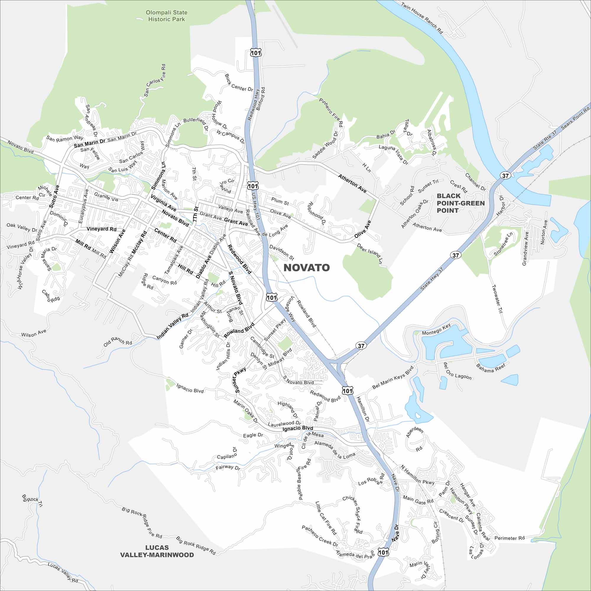
Novato sits at the northern edge of Marin County. Check out our map to see its residential areas bordered by hills and open space. The city spreads along Highway 101 toward wine country.
California State Maps
Explore California with our state maps


Map Information
On the Map
Interstates/Highways: US Hwy 101, State Rte 37 Major Roads: Novato Blvd, San Marin Dr, Redwood Blvd, Atherton Ave, Ignacio Blvd, Indian Valley Rd, South Novato Blvd, Rowland Blvd, Grant Ave, Center Rd, Wilson Ave, Vineyard Rd, Mill Rd, Arthur St, Olive Ave, Sunset Pkwy, Hamilton Dr, Main Gate Rd, Nave Dr, Marin Valley Dr Parks and Preserves: Olompali State Historic Park Nearby Communities: Black Point-Green Point, Lucas Valley-MarinwoodCalifornia City Maps
Here are detailed maps of California


