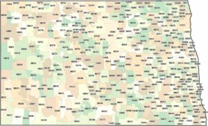
North Dakota Counties and Cities Map
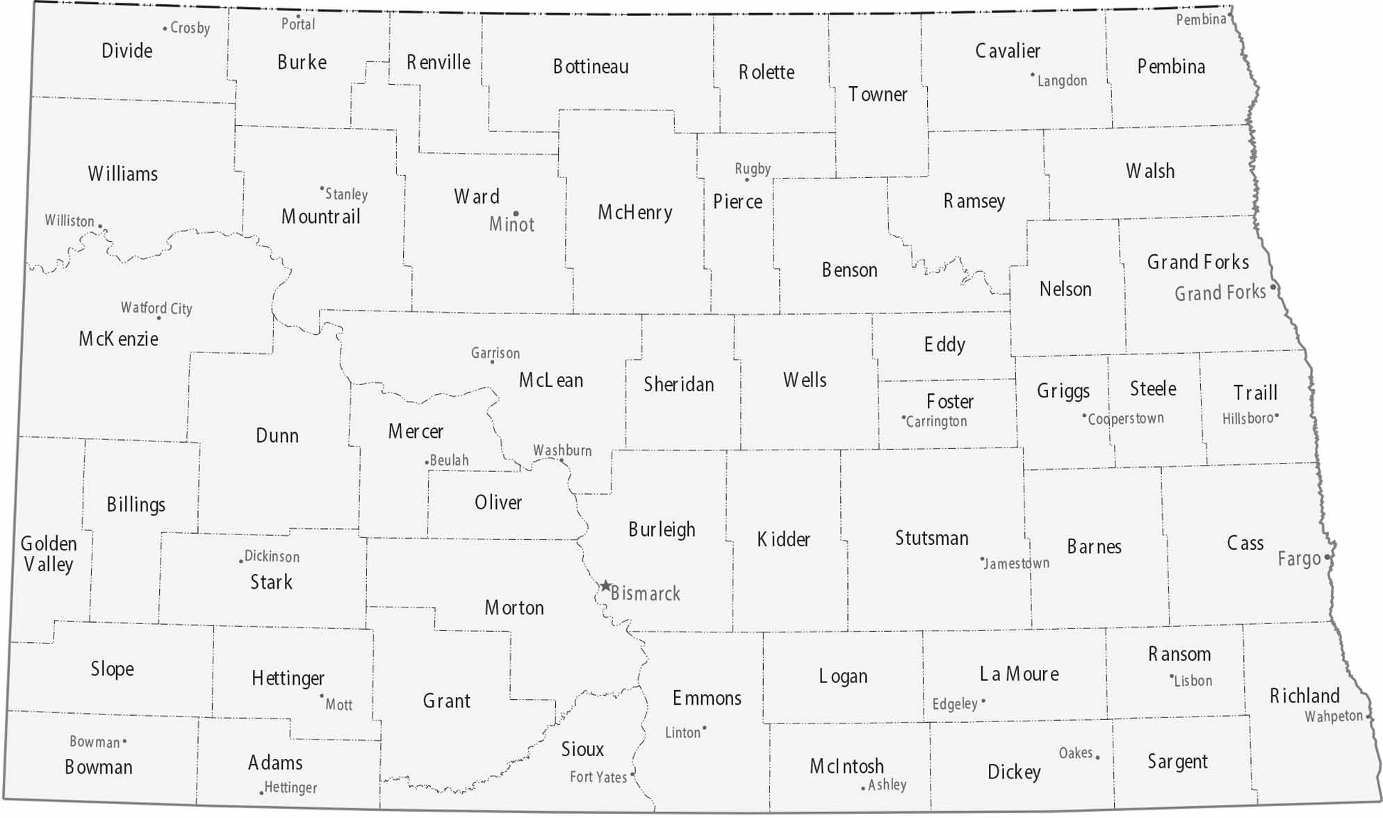
On our map of North Dakota, you will find its 53 counties mostly in agricultural areas. Fargo sits on the eastern border as the largest city. But Bismarck serves as the capital along the Missouri River.
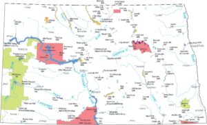
Map Information
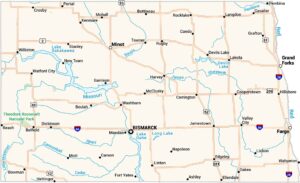
On the Map
|
Name |
Population 2024 |
Total Area (sq mi) |
FIPS Code |
|
Adams County |
2,141 |
988.7 |
38-001 |
|
Barnes County |
10,798 |
1,513.40 |
38-003 |
|
Benson County |
5,756 |
1,439.50 |
38-005 |
|
Billings County |
1,063 |
1,153.50 |
38-007 |
|
Bottineau County |
6,391 |
1,697.30 |
38-009 |
|
Bowman County |
2,886 |
1,167.10 |
38-011 |
|
Burke County |
2,154 |
1,128.90 |
38-013 |
|
Burleigh County |
103,107 |
1,668.30 |
38-015 |
|
Cass County |
200,945 |
1,767.90 |
38-017 |
|
Cavalier County |
3,567 |
1,510.00 |
38-019 |
|
Dickey County |
4,930 |
1,142.10 |
38-021 |
|
Divide County |
2,124 |
1,294.20 |
38-023 |
|
Dunn County |
4,031 |
2,082.00 |
38-025 |
|
Eddy County |
2,309 |
644.1 |
38-027 |
|
Emmons County |
3,209 |
1,555.00 |
38-029 |
|
Foster County |
3,323 |
646.8 |
38-031 |
|
Golden Valley County |
1,795 |
1,003.10 |
38-033 |
|
Grand Forks County |
73,771 |
1,439.50 |
38-035 |
|
Grant County |
2,247 |
1,665.90 |
38-037 |
|
Griggs County |
2,227 |
716.4 |
38-039 |
|
Hettinger County |
2,419 |
1,133.80 |
38-041 |
|
Kidder County |
2,371 |
1,432.90 |
38-043 |
|
LaMoure County |
4,051 |
1,150.90 |
38-045 |
|
Logan County |
1,880 |
1,011.20 |
38-047 |
|
McHenry County |
5,135 |
1,911.60 |
38-049 |
|
McIntosh County |
2,461 |
994.7 |
38-051 |
|
McKenzie County |
14,782 |
2,860.90 |
38-053 |
|
McLean County |
9,845 |
2,328.00 |
38-055 |
|
Mercer County |
8,348 |
1,112.50 |
38-057 |
|
Morton County |
34,194 |
1,945.40 |
38-059 |
|
Mountrail County |
9,474 |
1,941.50 |
38-061 |
|
Nelson County |
3,007 |
1,008.80 |
38-063 |
|
Oliver County |
1,882 |
731.2 |
38-065 |
|
Pembina County |
6,588 |
1,121.40 |
38-067 |
|
Pierce County |
3,853 |
1,082.30 |
38-069 |
|
Ramsey County |
11,510 |
1,300.90 |
38-071 |
|
Ransom County |
5,590 |
863.7 |
38-073 |
|
Renville County |
2,376 |
892.7 |
38-075 |
|
Richland County |
16,658 |
1,445.40 |
38-077 |
|
Rolette County |
11,692 |
939.3 |
38-079 |
|
Sargent County |
3,710 |
866.9 |
38-081 |
|
Sheridan County |
1,268 |
1,005.60 |
38-083 |
|
Sioux County |
3,713 |
1,128.20 |
38-085 |
|
Slope County |
660 |
1,219.10 |
38-087 |
|
Stark County |
33,767 |
1,340.20 |
38-089 |
|
Steele County |
1,767 |
715.5 |
38-091 |
|
Stutsman County |
21,546 |
2,297.90 |
38-093 |
|
Towner County |
2,051 |
1,041.50 |
38-095 |
|
Traill County |
7,989 |
862.5 |
38-097 |
|
Walsh County |
10,214 |
1,294.10 |
38-099 |
|
Ward County |
68,427 |
2,055.90 |
38-101 |
|
Wells County |
3,803 |
1,290.40 |
38-103 |
|
Williams County |
40,763 |
2,148.10 |
38-105 |
Counties and Cities Maps
Select any state map below to view its counties and cities map.


North Dakota State Maps
Find the map you need of the Peace Garden State.