New Mexico National Parks and Forests Map
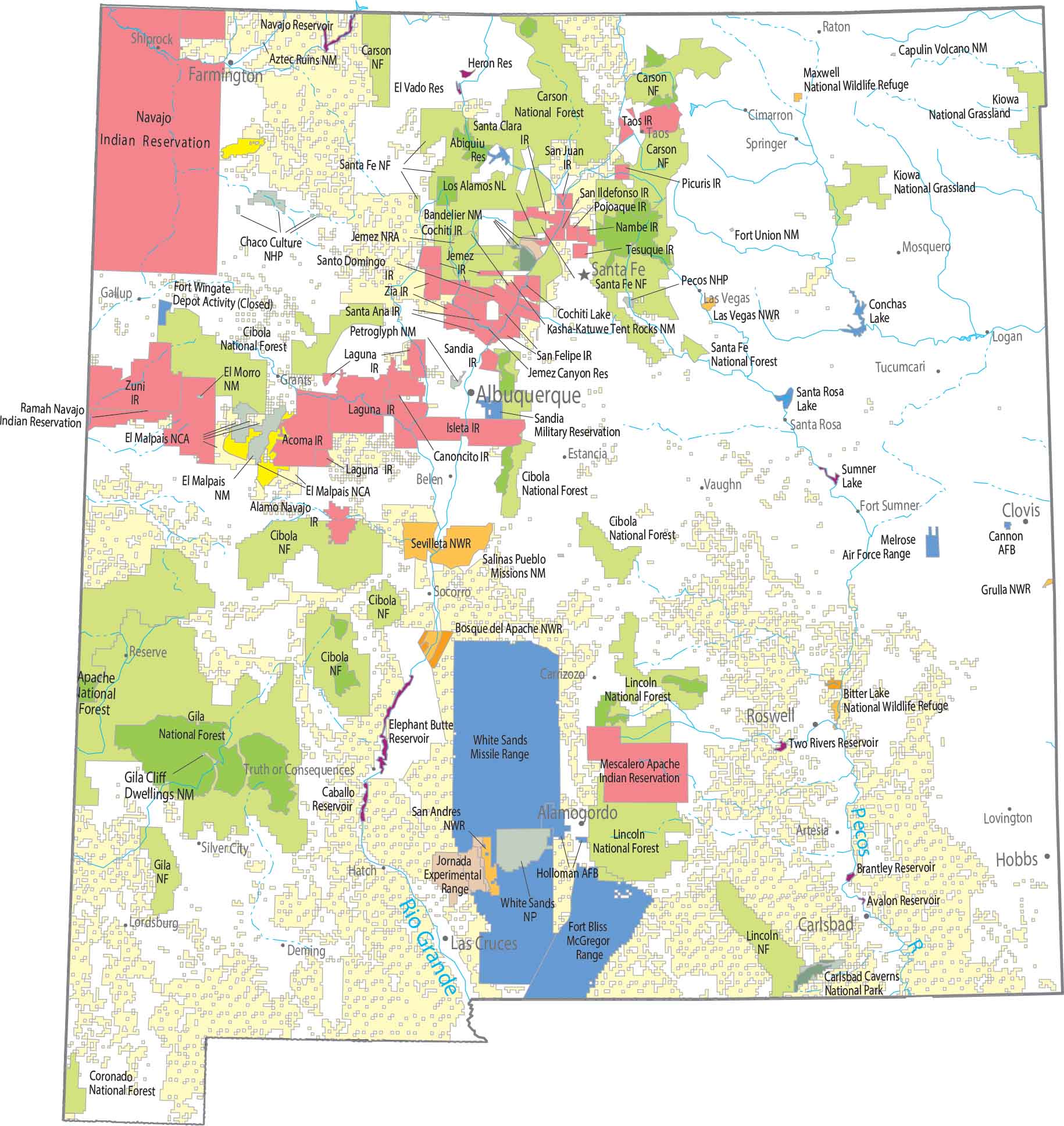
Caves below, dunes above. Carlsbad Caverns goes straight underground, while White Sands is wide open and hard to miss. Our map shows national forests like Gila and Santa Fe that fill in the mountains between.
Map Information
On the Map
Parks, Forests and Federal Lands
National Parks (NP): Carlsbad Caverns NP, Chaco Culture National Historic Park, Pecos National Historic Park National Forests (NF): Apache NF, Carson NF, Cibola NF, Coronado NF, Gila NF, Lincoln NF, Santa Fe NF National Wildlife Refuges (NWR): Bitter Lake NWR, Bosque del Apache NWR, Grulla NWR, Las Vegas NWR, Maxwell NWR, San Andres NWR, Sevilleta NWR National Monuments (NM): Aztec Ruins NM, Bandelier NM, Capulin Volcano NM, El Morro NM, Fort Union NM, Gila Cliff Dwellings NM, Kasha-Katuwe Tent Rocks NM, Petroglyph NM, Salinas Pueblo Missions NM, White Sands NM Other Federal Lands: El Malpais National Conservation Area, Jemez National Recreation Area, Kiowa National Grassland, Los Alamos National Laboratory Indian Reserves (IR): Acoma IR, Alamo Navajo IR, Canoncito IR, Cochiti IR, Isleta IR, Jemez IR, Laguna IR, Mescalero Apache IR, Nambe IR, Navajo IR, Picuris IR, Pojoaque IR, Ramah Navajo IR, San Felipe IR, San Ildefonso IR, San Juan IR, Sandia IR, Santa Ana IR, Santa Clara IR, Santa Fe NF, Santo Domingo IR, Taos IR, Tesuque IR, Ute Mountain IR, Zia IR, Zuni IR Army, Naval and Military: Cannon Air Force Base, Fort Bliss, Fort Wingate Depot Activity (Closed), Holloman Air Force Base, Jornada Experimental Range, McGregor Range, Melrose Air Force Range, Sandia Military Reservation, White Sands Missile RangeLand Information
State Capital: Santa Fe Major Cities: Albuquerque, Las Cruces, Roswell Cities and Towns: Alamogordo, Artesia, Aztec, Belen, Carlsbad, Carrizozo, Cimarron, Clovis, Deming, Estancia, Farmington, Fort Sumner, Gallup, Grants, Hatch, Hobbs, Las Vegas, Logan, Lordsburg, Lovington, Mosquero, Raton, Reserve, Santa Rosa, Shiprock, Silver City, Socorro, Springer, Taos, Truth or Consequences, Tucumcari, Vaughn Lakes and Reservoirs: Abiquiu Reservoir, Avalon Reservoir, Brantley Reservoir, Caballo Reservoir, Cochiti Lake, Conchas Lake, El Vado Reservoir, Elephant Butte Reservoir, Heron Reservoir, Jemez Canyon Reservoir, Navajo Reservoir, Santa Rosa Lake, Sumner Lake, Two Rivers Reservoir Rivers and Streams: Pecos River, Rio Grande RiverNew Mexico State Maps
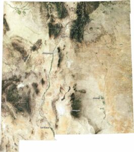
See maps across deserts, peaks, and towns of New Mexico.