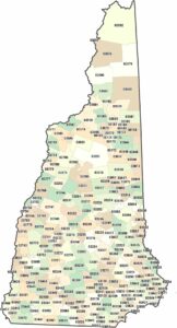
New Hampshire Counties and Cities Map
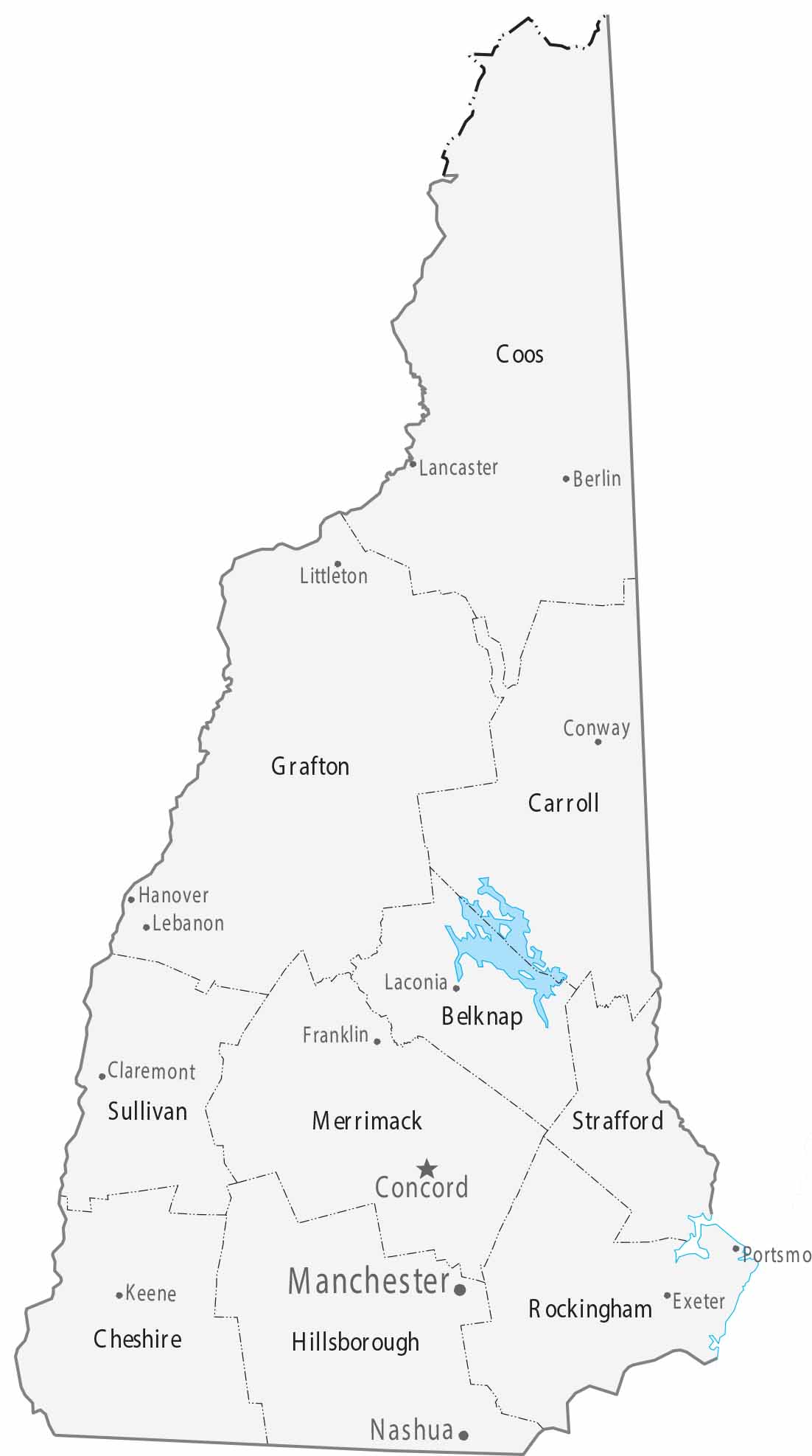
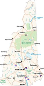
The 10 counties on our map of New Hampshire stretch from the small Atlantic coastline to the White Mountains. Manchester stands as the largest city, with Concord serving as the historic capital in the Merrimack Valley.
Map Information
On the Map
|
Name |
Population 2024 |
Total Area (sq mi) |
FIPS Code |
|
Belknap County |
65,257 |
470 |
33-001 |
|
Carroll County |
52,580 |
993.5 |
33-003 |
|
Cheshire County |
78,078 |
728.9 |
33-005 |
|
Coos County |
31,094 |
1,830.30 |
33-007 |
|
Grafton County |
93,045 |
1,749.70 |
33-009 |
|
Hillsborough County |
430,462 |
892.5 |
33-011 |
|
Merrimack County |
157,869 |
955 |
33-013 |
|
Rockingham County |
322,433 |
795.2 |
33-015 |
|
Strafford County |
134,202 |
382.6 |
33-017 |
|
Sullivan County |
44,012 |
552.1 |
33-019 |
Counties and Cities Maps
Select any state map below to view its counties and cities map.


New Hampshire State Maps
Select one of our maps of the Granite State.