Map of National City, California
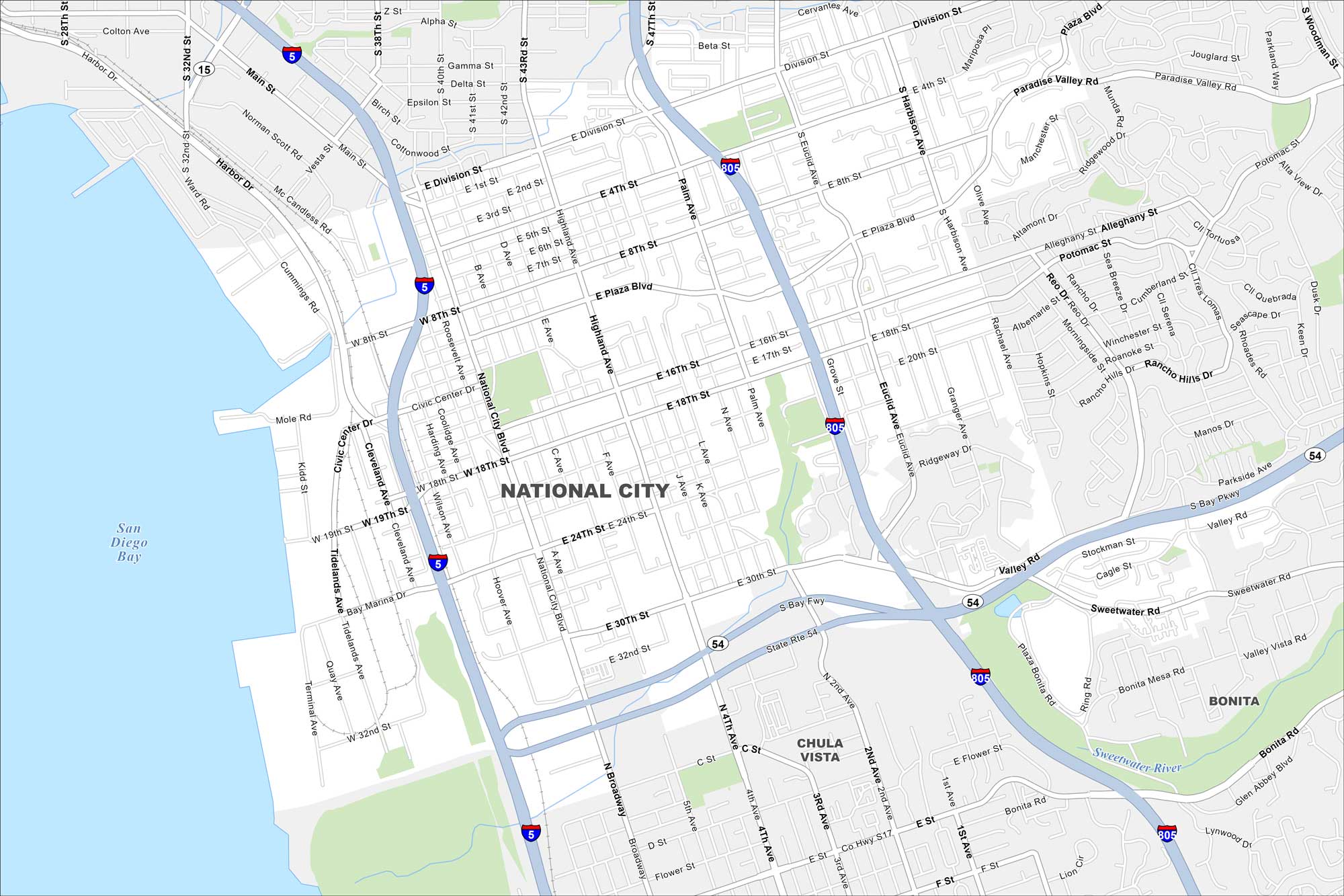
Our map of National City outlines a community just south of San Diego. Freeways cut through the city, connecting the whole city. The port and naval facilities shape much of its activity.
California State Maps
Explore California with our state maps


Map Information
On the Map
Interstates/Highways: I-5, I-805, State Rte 54 Major Roads: 8th St, 18th St, 24th St, 30th St, Highland Ave, National City Blvd, Cleveland Ave, Plaza Blvd, Division St, Harbison Ave, Euclid Ave, Valley Rd, Sweetwater Rd, Broadway, Main St, 32nd St, Tidelands Ave, Quay Ave, 4th Ave, 2nd Ave Lakes and Reservoirs: San Diego Bay Major Rivers: Sweetwater River Nearby Communities: Chula Vista, BonitaCalifornia City Maps
Here are detailed maps of California


