Map of Monrovia, California
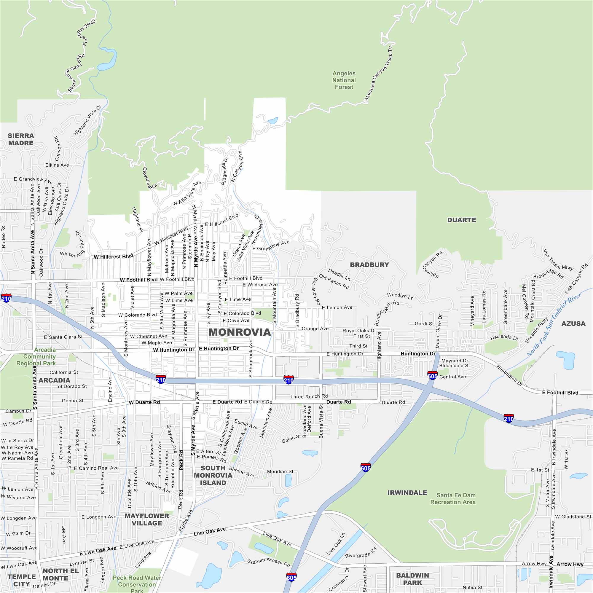
Take a look at our map of Monrovia in Los Angeles County. This city sits right against the San Gabriel Mountains, with Old Town at its center. The foothill location gives it a unique setting.
California State Maps
Explore California with our state maps


Map Information
On the Map
Interstates/Highways: I-210, I-605 Major Roads: Huntington Dr, Myrtle Ave, Foothill Blvd, Duarte Rd, Peck Rd, Live Oak Ave, Mountain Ave, Shamrock Ave, Mayflower Ave, Colorado Blvd, Hillcrest Blvd, Grand Ave, California Ave, Fifth Ave, Central Ave, Fifth Canyon Rd, Fish Canyon Rd, Encanto Pkwy, Arrow Hwy, Royal Oaks Dr Major Rivers: North Fork San Gabriel River Parks and Preserves: Angeles National Forest, Arcadia Community Regional Park, Peck Road Water Conservation Park, Santa Fe Dam Recreation Area Nearby Communities: Sierra Madre, Arcadia, Mayflower Village, South Monrovia Island, Duarte, Bradbury, Irwindale, Azusa, Baldwin Park, North El Monte, Temple CityCalifornia City Maps
Here are detailed maps of California


