Map of Millbrae, California
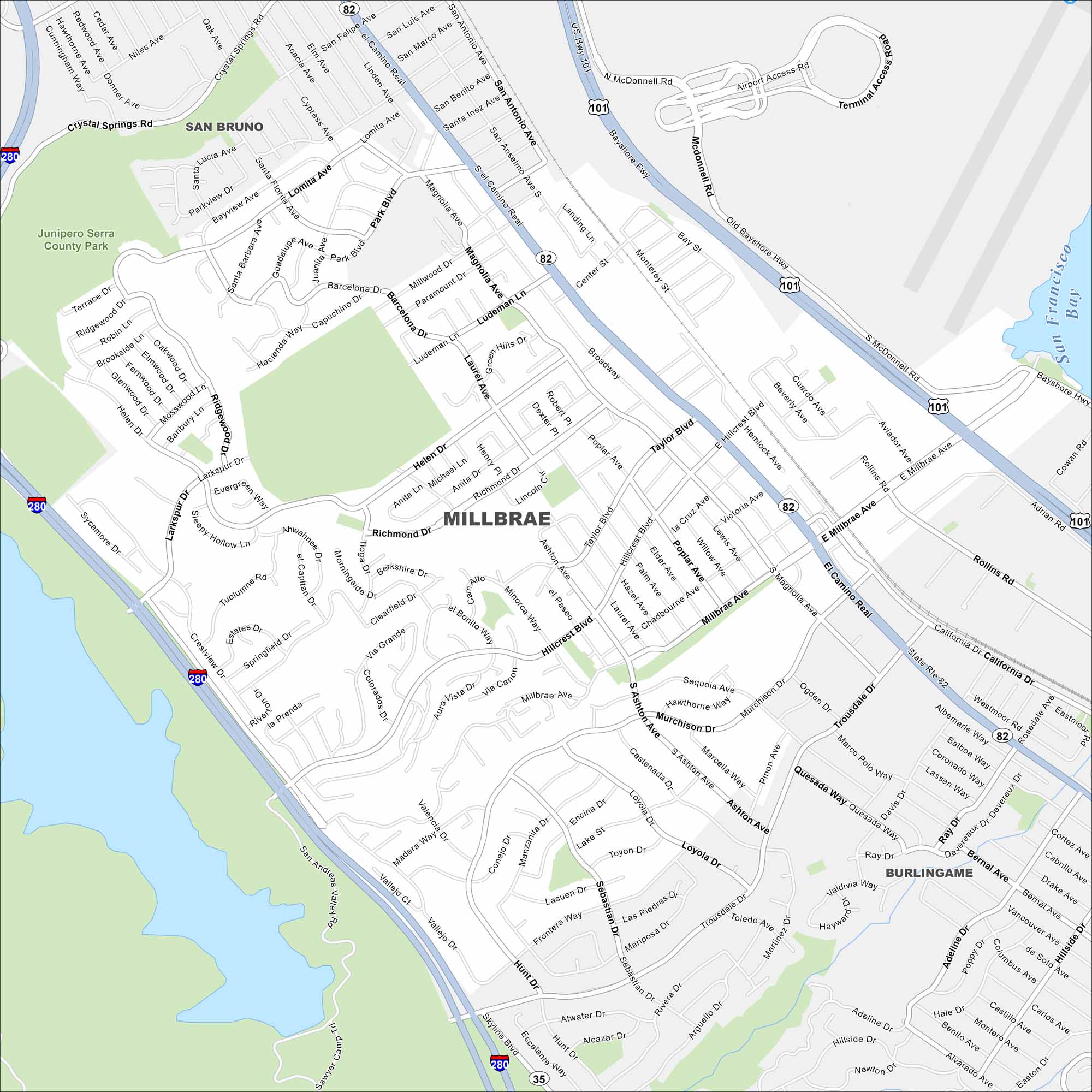
Our map of Millbrae highlights its location along San Francisco Bay. The city is known for its BART and Caltrain connections. You often see residential neighborhoods rise into the nearby hills.
California State Maps
Explore California with our state maps


Map Information
On the Map
Interstates/Highways: I-280, US Hwy 101, State Rte 82, State Rte 35 Major Roads: El Camino Real, Millbrae Ave, Skyline Blvd, Broadway, Hillcrest Blvd, Taylor Blvd, Trousdale Dr, Rollins Rd, Bayshore Fwy, Larkspur Dr, Richmond Dr, Magnolia Ave, Millwood Dr, Helen Dr, San Anselmo Ave, San Felipe Ave, San Luis Ave, Center Rd, Murchison Dr, Sebastian Dr Lakes and Reservoirs: San Francisco Bay, San Andreas Lake Parks and Preserves: Junipero Serra County Park Nearby Communities: San Bruno, BurlingameCalifornia City Maps
Here are detailed maps of California


