Map of Middlesex Borough, New Jersey
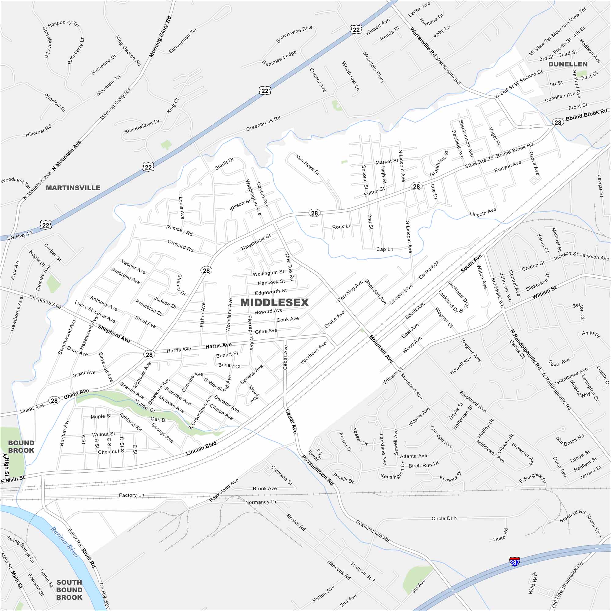
We’ve mapped Middlesex with its location along the Raritan River. Our map shows its mix of neighborhoods, parks, and highways/roads. It’s also well connected by nearby highways and rail.
Map Information
On the Map
Interstates/Highways: I-287, US Hwy 22, State Rte 28 Major Roads: Bound Brook Rd, Lincoln Blvd, Mountain Ave, Possumtown Rd, Greenbrook Rd, Union Ave, Harris Ave, South Ave, Warrenville Rd, Raritan Ave, River Rd, Main St, North Ave, Sebring Rd, Cedar Ave, Voorhees Ave, Drake Ave, Pershing Ave, Second St, Market St Major Rivers: Raritan River Nearby Communities: Martinsville, Dunellen, Bound Brook, South Bound BrookNew Jersey State Maps
Explore maps from the Garden State.


City Maps of New Jersey
Newark and New Jersey cities in complete detail


