Map of Merced, California
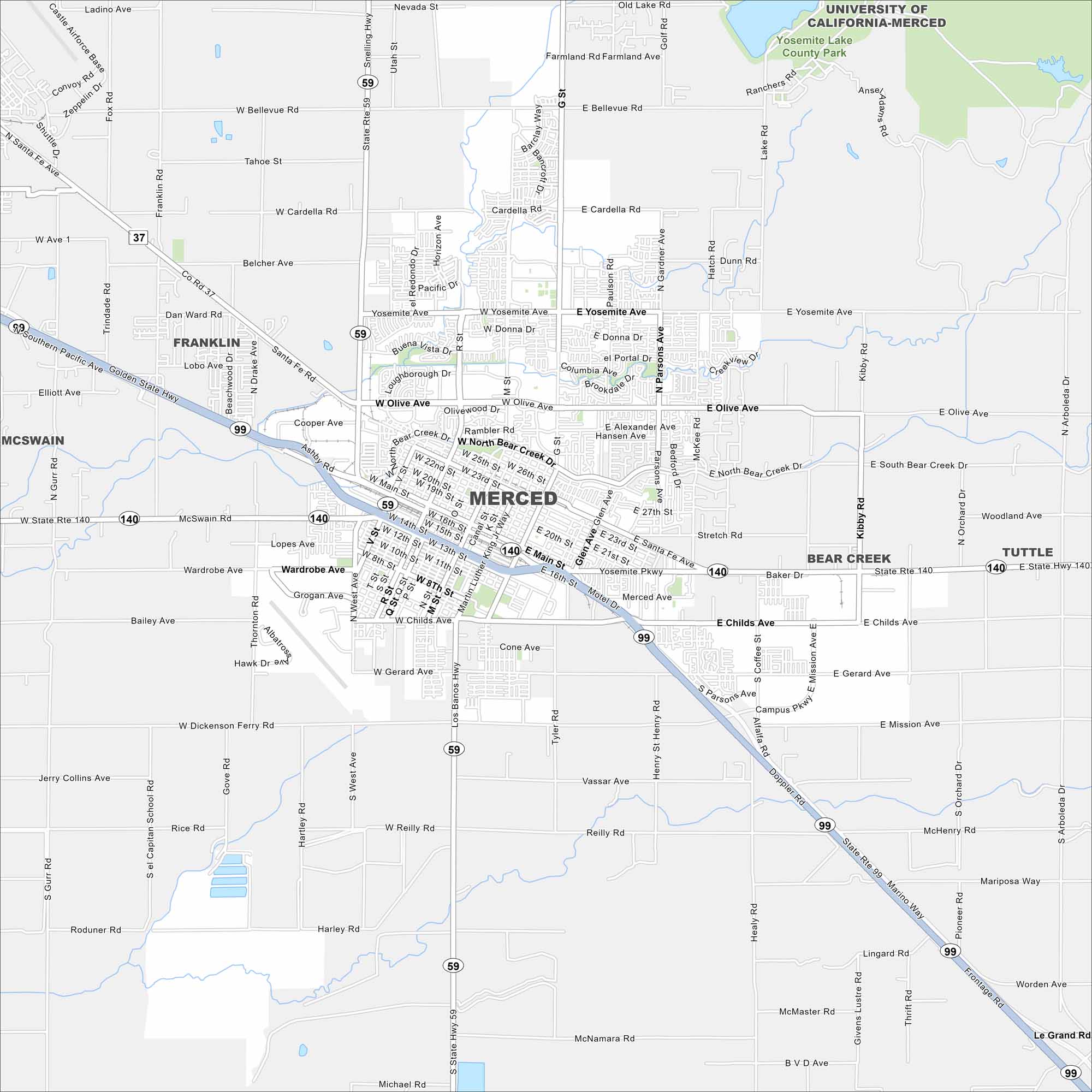
Here’s our map of Merced in California’s Central Valley. Our map shows its road network, nearby farmland, and UC Merced campus. People visit here as a gateway to Yosemite National Park.
California State Maps
Explore California with our state maps


Map Information
On the Map
Interstates/Highways: State Rte 99, State Rte 59, State Rte 140 Major Roads: Olive Ave, Yosemite Ave, Main St, Childs Ave, G St, Martin Luther King Jr Way, Bear Creek Dr, Gerard Ave, Mission Ave, Bellevue Rd, Cardella Rd, M St, Parsons Ave, Santa Fe Dr, Ashby Rd, Snelling Hwy, Los Banos Hwy, Orchard Rd, Arboleda Drive, Campus Pkwy Lakes and Reservoirs: Yosemite Lake Parks and Preserves: Yosemite Lake County Park Nearby Communities: Franklin, McSwain, Bear Creek, TuttleCalifornia City Maps
Here are detailed maps of California


