Map of Menomonee Falls, Wisconsin
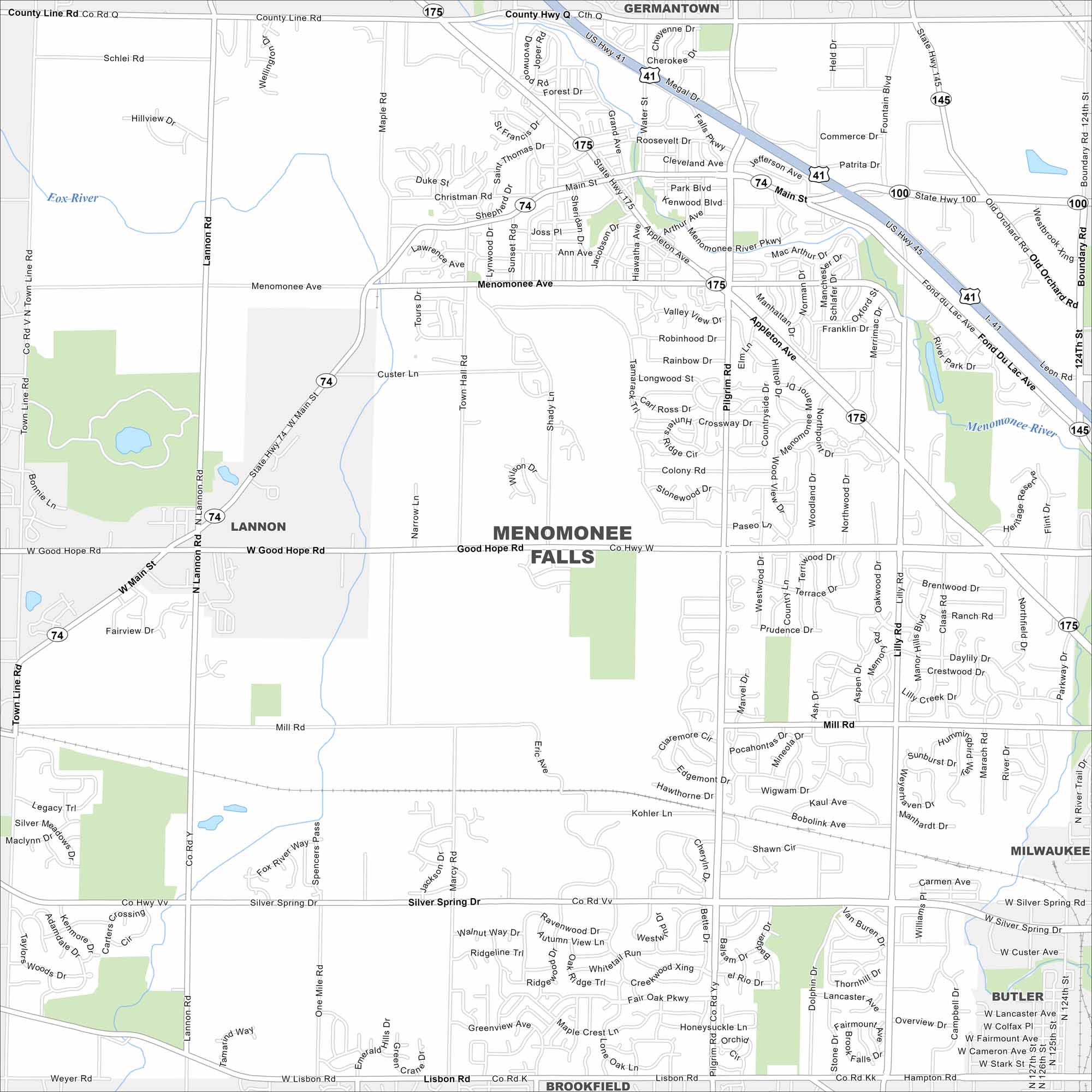
Our map of Menomonee Falls highlights its suburban layout northwest of Milwaukee. The village combines residential neighborhoods with light industry. The Menomonee River runs through the center of the village.
Map Information
On the Map
Interstates/Highways: US Hwy 41, US Hwy 45, State Rte 74, State Rte 100, State Rte 145, State Rte 175 Major Roads: Main St, Good Hope Rd, Silver Spring Dr, Appleton Ave, Menomonee Ave, County Line Rd, Mill Rd, Lisbon Rd, Lannon Rd, Boundary Rd, Pilgrim Rd, Lilly Rd, Pilgrim Pkwy, Town Line Rd, Fond Du Lac Ave, Roosevelt Dr, Water St, Shady Ln, Maple Rd, Marcy Rd Major Rivers: Menomonee River Nearby Communities: Lannon, Butler, Brookfield, Germantown, MilwaukeeWisconsin State Maps
Discover maps of the Badger State.


City Maps of Wisconsin
See our Wisconsin maps designed for clarity.


