Kentucky Zip Code Map
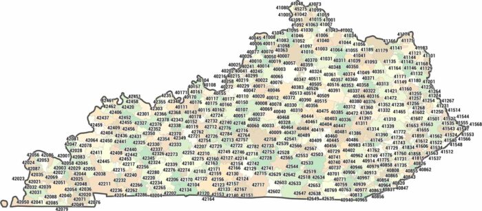
With over 750 zip codes, Kentucky stretches through 400 to 427. This Kentucky zip code map shows how zip codes follow the hills and valleys.
With over 750 zip codes, Kentucky stretches through 400 to 427. This Kentucky zip code map shows how zip codes follow the hills and valleys.
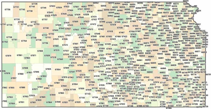
See how zip codes stretch across Kansas. Our Kansas zip code map shows large postal areas shaped by open land and small towns.
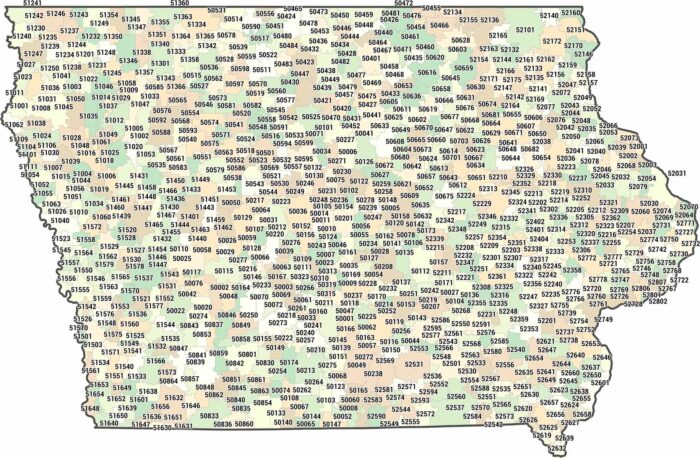
Iowa zip codes cover a lot of ground, spanning 500XX to 528XX. Our Iowa zip code map shows wide postal areas between towns.
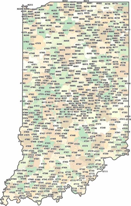
Our map of Indiana highlights how evenly zip codes cover the state. Indiana runs through 460 to 479, covering Indianapolis to Midwest towns.
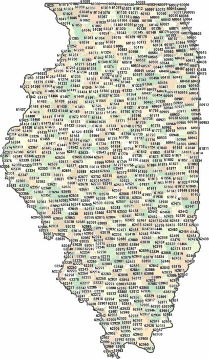
Illinois zip codes cluster tightly around Chicago and spread out elsewhere. We’ve mapped every zip code from the lakefront to the south.
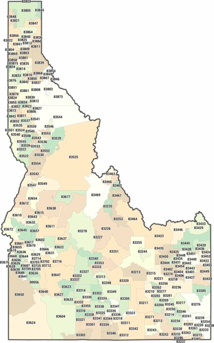
Our map of Idaho breaks down zip codes across a large and rugged state. Many zip codes cover wide rural areas in mountainous areas.
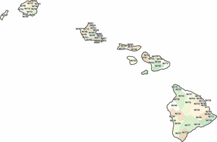
Explore the islands spread across the central Pacific. Our map shows ZIP codes across Oahu, Maui, Hawaii Island, and the smaller islands.
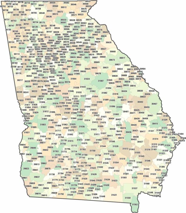
Georgia spreads across 705 zip codes starting at 30000. This map shows how zip codes flow from Appalachian trails down to Savannah.
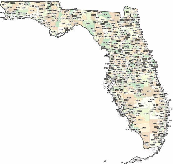
Hunt down any address in the Sunshine State with this Florida zip code map. Florida sprawls across 320XX to 349XX.
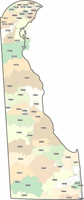
Delaware keeps things tight with just 66 zip codes in the 197-199 range. Use this map to pinpoint any Delaware address. Compact and simple.
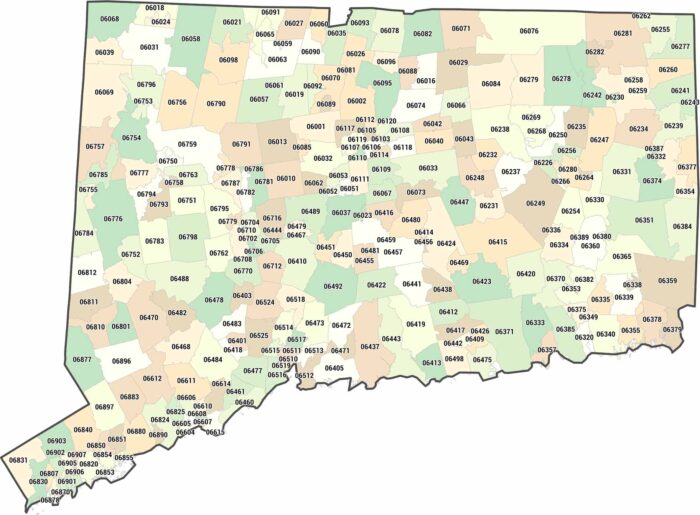
Need a Connecticut zip code map? Our map breaks down its 06 range. For such a small state, Connecticut still has 281 zip codes.
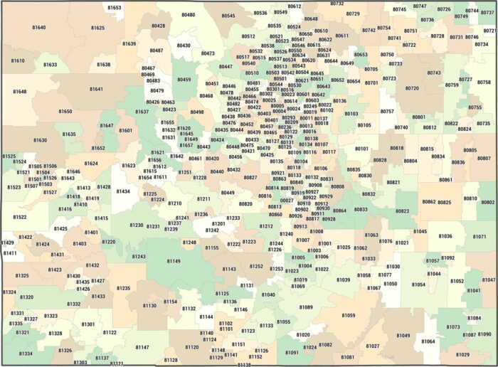
Our Colorado zip code map runs from 80000 to 81699. It includes Denver, Boulder, and the mountain towns in between.
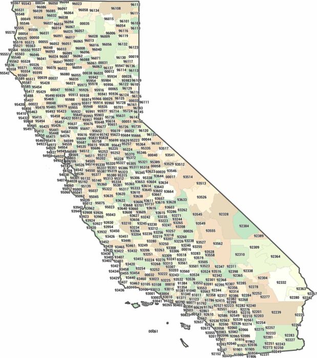
This California zip code map breaks down the massive 9xxxx range. This map shows you where LA, San Francisco and San Diego belong.
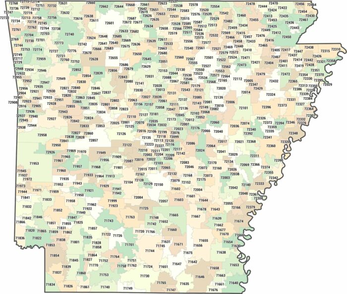
Arkansas uses zip codes from 71600 to 72999, all starting with 7. This Arkansas zip code map shows you where Little Rock and everywhere lands.
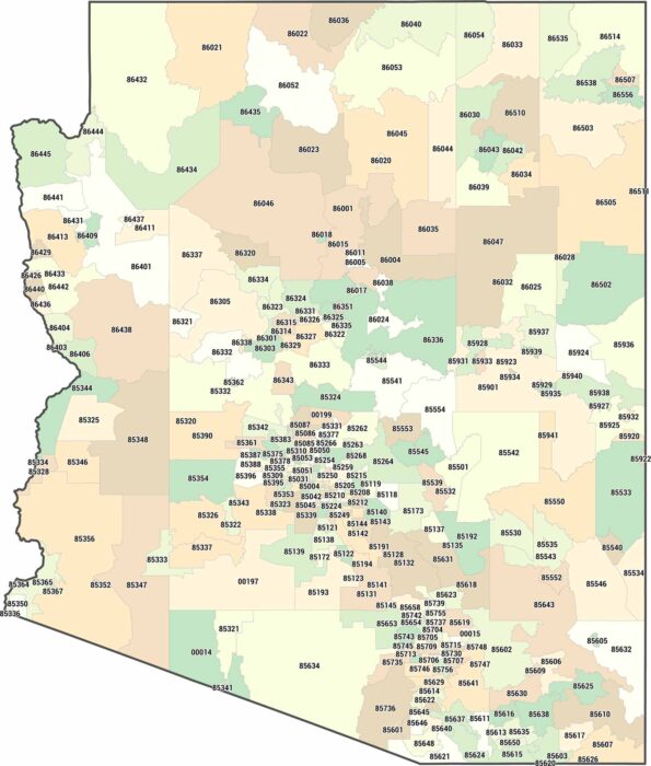
Need to find an Arizona zip code? From the deserts to its mountains, this map breaks down the 85xxx and 86xxx ranges across the state.