Dulles International Airport Map
Located west of Washington, D.C., this airport handles millions of travelers yearly. Our map shows terminals, runways and highways.
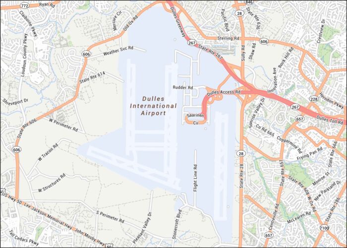
Located west of Washington, D.C., this airport handles millions of travelers yearly. Our map shows terminals, runways and highways.
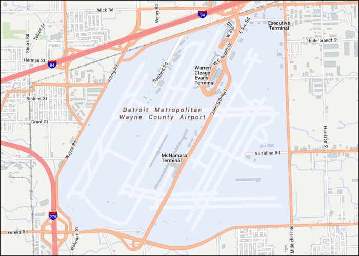
Explore our Detroit Airport map, located in the southwest of Motor City. Our map highlights terminals, runways, highways, and streets.
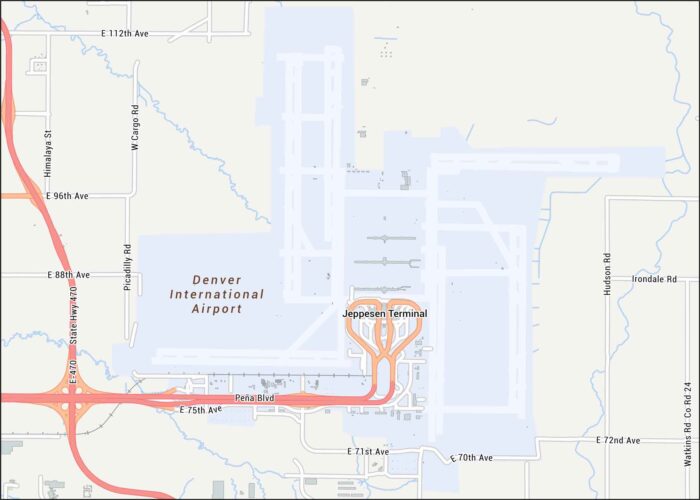
Here’s our Denver International Airport map, which sits northeast of Denver. Our map shows runways, nearby highways, and local streets.
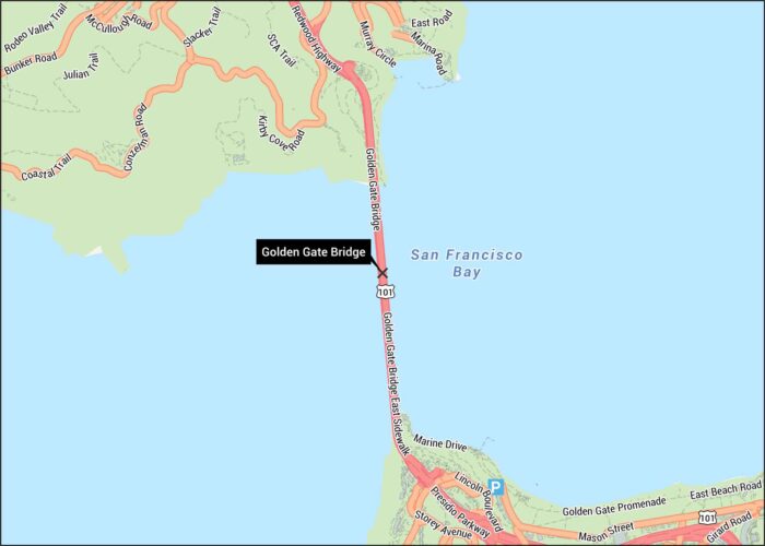
Behold. The Golden Gate Bridge spans the strait between San Francisco and Marin. Our Golden Gate Bridge map shows highways, roads, and paths.
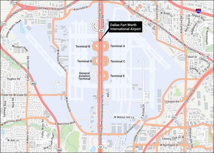
Our map of Dallas International Airport gives a clear overview with terminals and runways. The airport sits between Dallas and Fort Worth.
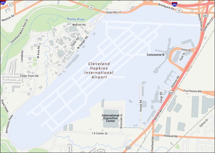
Explore our Cleveland International Airport map. Our map shows terminals, runways, highways, and concourses.
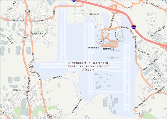
Our Cincinnati International Airport map shows terminals, runways, highways, and roads. The airport sits just southwest of Cincinnati.
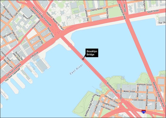
Explore our detailed Brooklyn Bridge map. Our map shows roads, highways, walkways piers and of course, the East River.
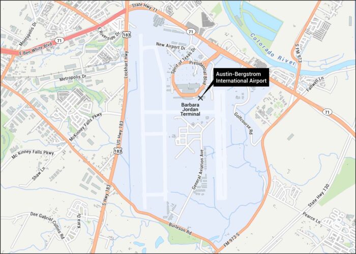
Our map shows the layout at Austin’s main airport that sits off Highway 71. You can see highways, runways and the main terminal.
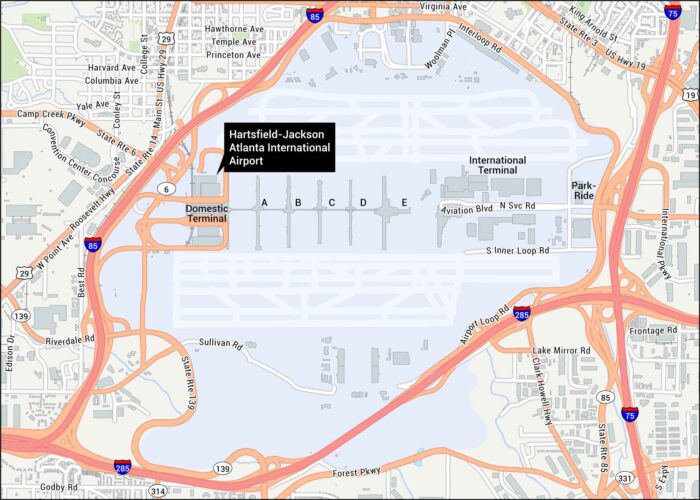
Get to know the world’s busiest airport. Our map shows Atlanta International Airport with its terminals and concourses.
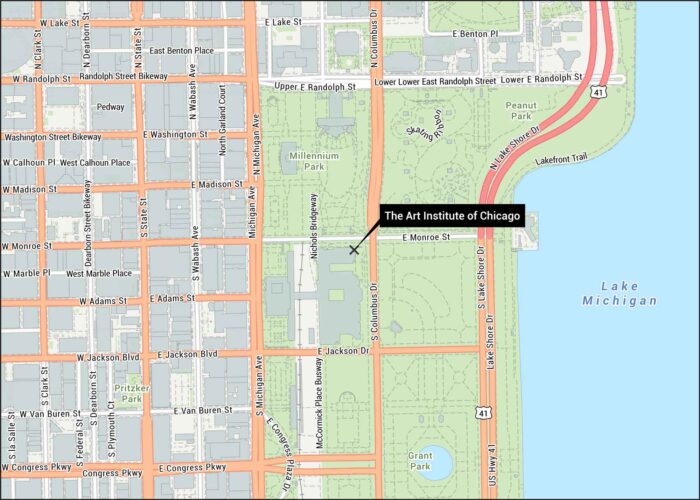
Our map of the Art Institute of Chicago shows its location in downtown Chicago. You’ll find it along Michigan Avenue next to Millennium Park.
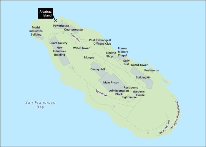
Our map of Alcatraz shows the island’s layout in San Francisco Bay. It includes the cell house, dining hall, and walking paths.
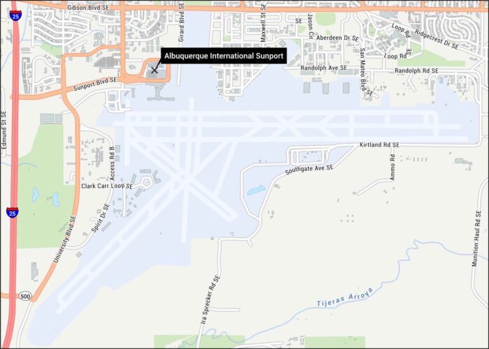
Check out our map showing the Sunport’s layout. You’ll find runways, the main terminal, and surrounding roads like Interstate 25.
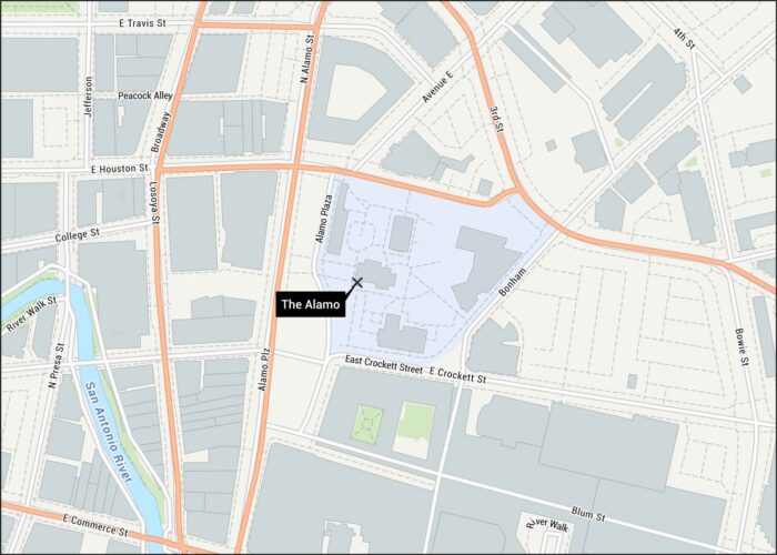
This map shows the Alamo grounds in downtown San Antonio. You’ll see all the surrounding streets, paths and the San Antonio River.
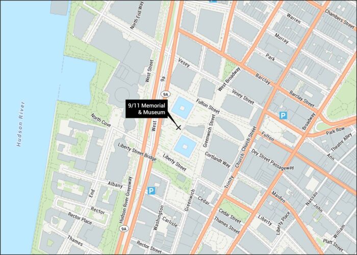
Our map shows the 9/11 Memorial and Museum layout in Lower Manhattan. The twin reflecting pools mark where the towers once stood.