Atlanta International Airport Map
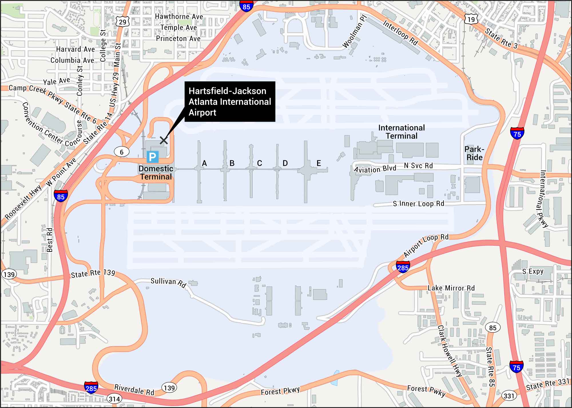
Our map shows Atlanta International Airport that sits south of downtown. You can see the domestic and international terminals with all its concourses. Get to know the world’s busiest airport with our map.
Map Information
On the Map
Interstates/Highways: I-85, I-285, I-75, US Hwy 19, US Hwy 29
Major Roads: Roosevelt Hwy, Camp Creek Pkwy, Forest Pkwy, Riverdale Rd, Clark Howell Hwy, International Pkwy, Airport Loop Rd, Sullivan Rd, State Rte 139, State Rte 85, State Rte 6, State Rte 14, State Rte 3, Main St, Virginia Ave, Loop Rd, Aviation Blvd, Frontage Rd, Godby Rd, Best Rd
Other Landmarks: Domestic Terminal, International Terminal, Concourse A, Concourse B, Concourse C, Concourse D, Concourse E, Convention Center Concourse, Park-Ride
Tourist Maps in Georgia
Discover all the prime locations with our tourist maps.
No posts