Art Institute of Chicago Map
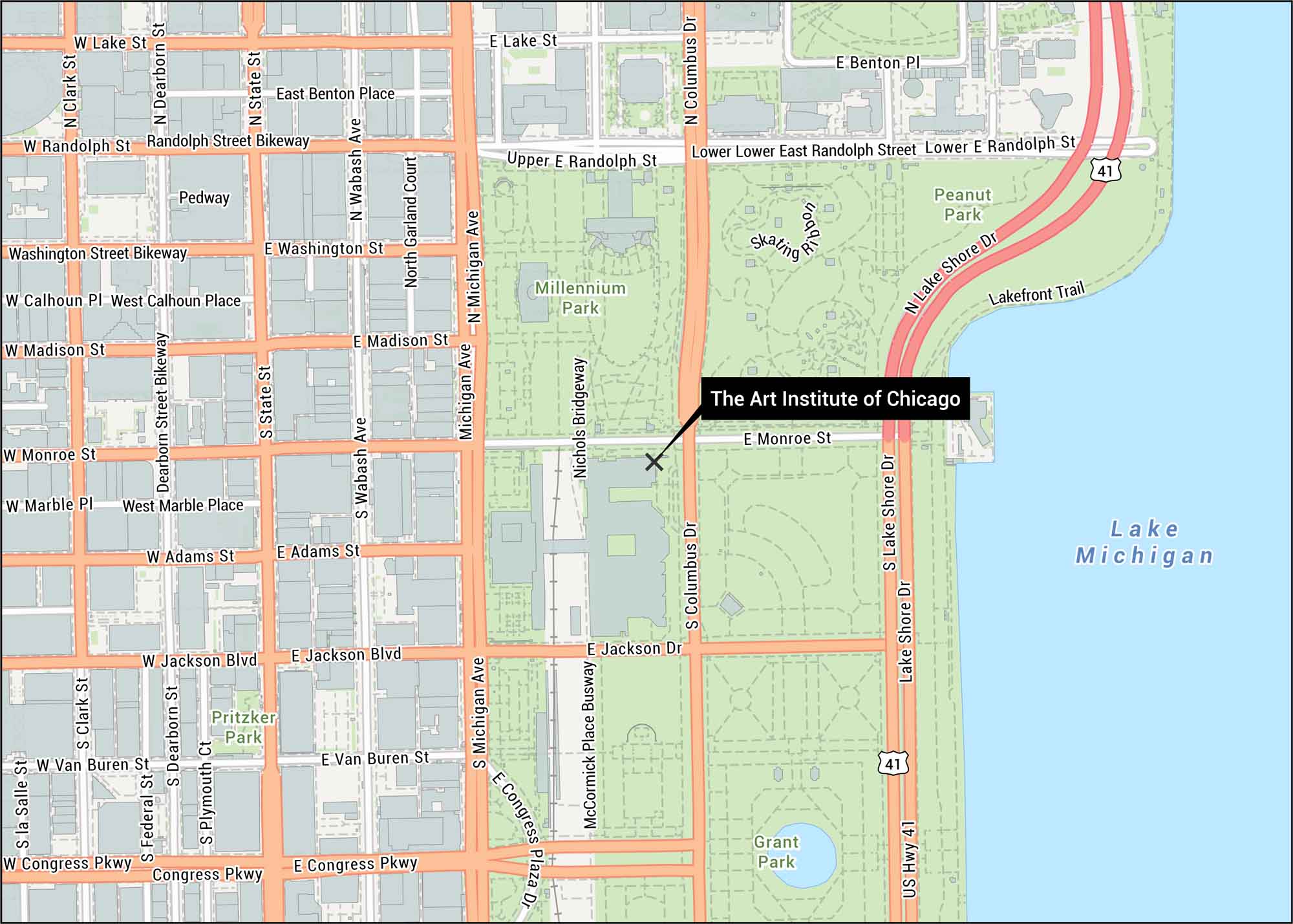
Our map of the Art Institute of Chicago shows its location in downtown Chicago. You’ll find it along Michigan Avenue next to Millennium Park. It has close access to Lake Michigan and Grant Park.
Map Information
On the Map
Interstates/Highways: US Hwy 41 Major Roads: Michigan Ave, Lake Shore Dr, Columbus Dr, Congress Pkwy, Jackson Blvd, Madison St, Monroe St, Randolph St, Lake St, Washington St, Adams St, Van Buren St, Roosevelt Rd, Wabash Ave, State St, Dearborn St, Clark St, LaSalle St, Wacker Dr, Franklin St Rivers/Lakes: Lake Michigan Parks/Forests: Grant Park, Millennium Park, Peanut Park, Pritzker Park Other Landmarks: Lakefront Trail, Nichols Bridgeway, McCormick Place Busway, Skating Ribbon, PedwayTourist Maps in Illinois
Discover all the prime locations with our tourist maps.