Albuquerque Airport Map
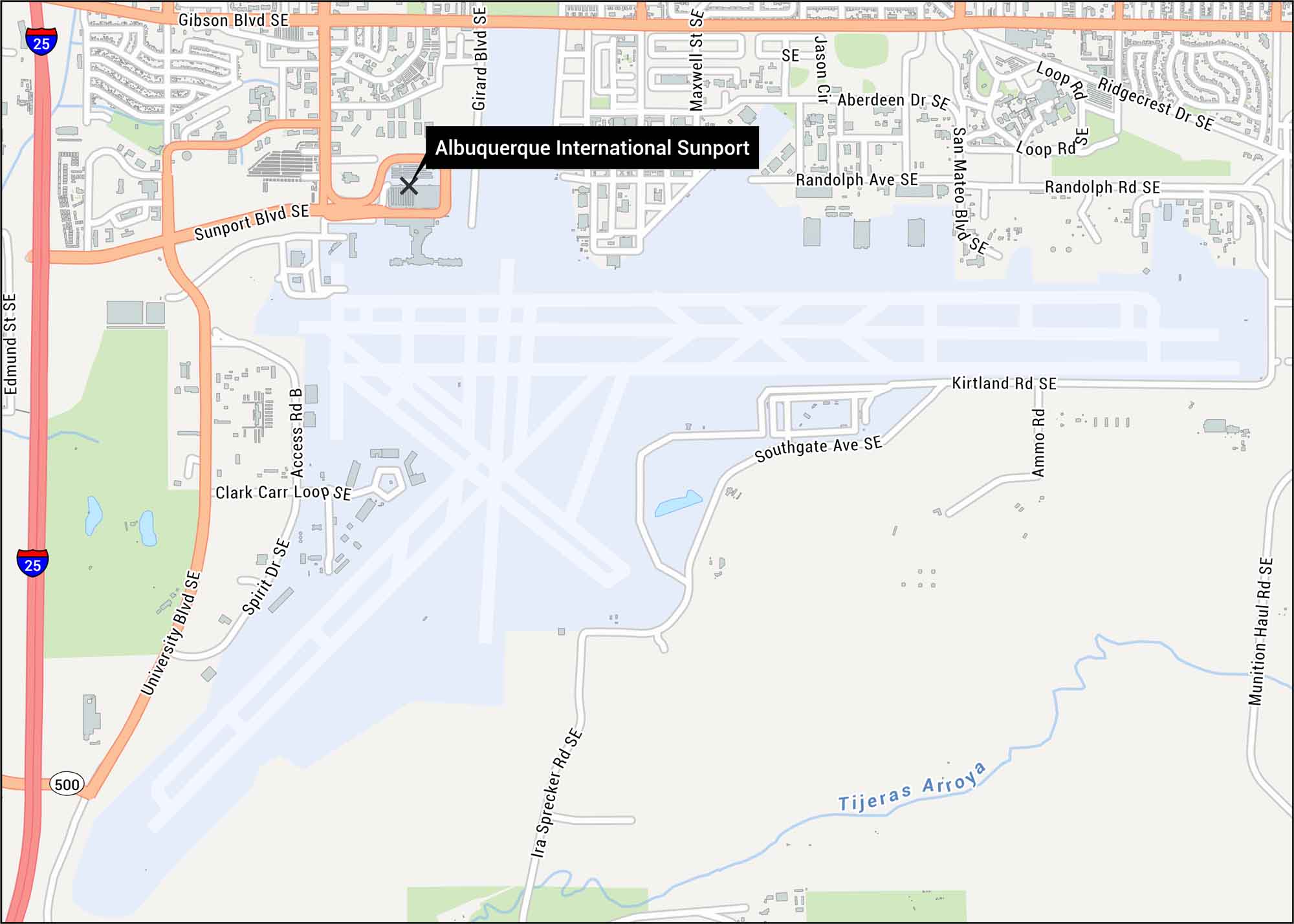
Check out our map showing the Sunport’s layout. You’ll find runways, the main terminal, and surrounding roads. You can see how the airport connects to I-25 and nearby streets in southeast Albuquerque.
Map Information
On the Map
Interstates/Highways: I-25, State Rte 500 Major Roads: Sunport Blvd SE, Gibson Blvd SE, University Blvd SE, Girard Blvd SE, Maxwell St SE, San Mateo Blvd SE, Randolph Ave SE, Kirtland Rd SE, Southgate Ave SE, Clark Carr Loop SE, Spirit Dr SE, Access Rd B, Edmund St SE, Aberdeen Dr SE, Loop Rd, Ridgecrest Dr SE, Randolph Rd SE, Ammo Rd, Munition Haul Rd SE, Ira Sprecher Rd SE Rivers/Lakes: Tijeras ArroyoTourist Maps in New Mexico
Discover all the prime locations with our tourist maps.