Lambert Airport Map
Lambert Airport is shown here with its terminals and runways. Our map gives you a view of the airport’s highways, which serves St. Louis.
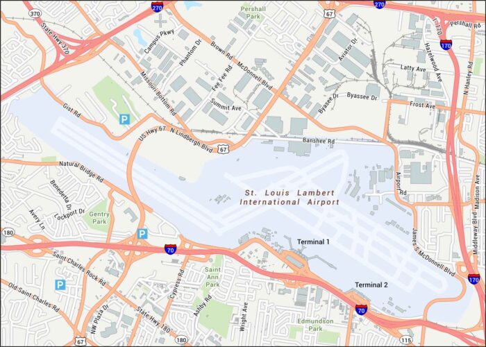
Lambert Airport is shown here with its terminals and runways. Our map gives you a view of the airport’s highways, which serves St. Louis.
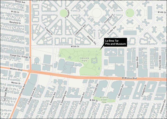
Our map of the La Brea Tar Pits lays out the park paths, museum area, and streets. We’ve also mapped the green spaces around the pits.
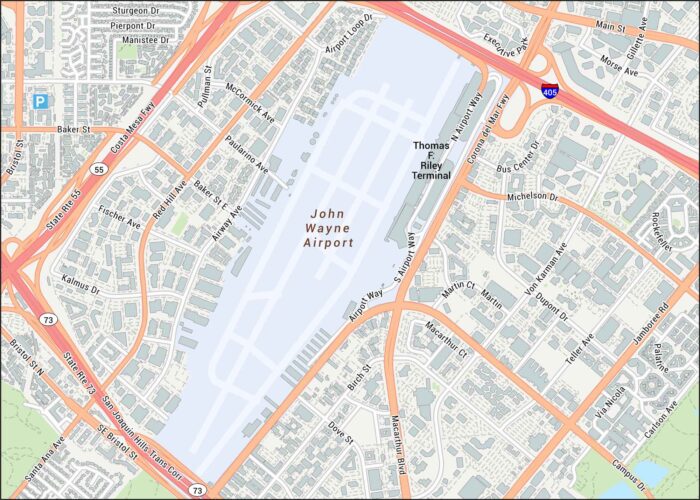
Take a look at John Wayne Airport to see the main roads, terminals, and runway layout. Our map keeps things simple with highways and suburbs.
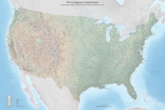
This is a high-resolution map with every detail you could need. Our USA detailed map has cities, physical features, state outlines, and more.
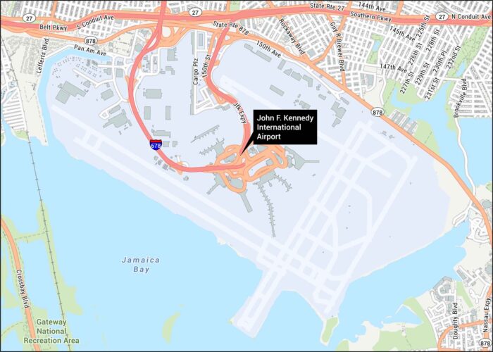
JFK Airport welcomes millions yearly. Located in Queens, New York, it’s a major international hub. Our map shows runways, highways and Jamaica Bay. Map Information On the Map Interstates/Highways: I-678, State Rte 27, State Rte 878, JFK Expy Major Roads: Southern Pkwy, Belt Pkwy, Nassau Expy, S Conduit Ave, N Conduit Ave, Guy R Brewer…
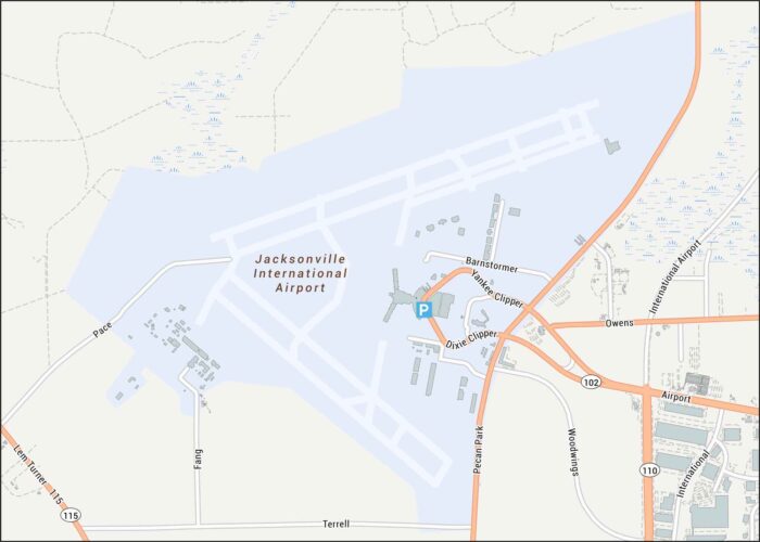
Our Jacksonville airport map allows you to fly into Jacksonville with ease. Our map highlights runways, highways, parking, and streets.
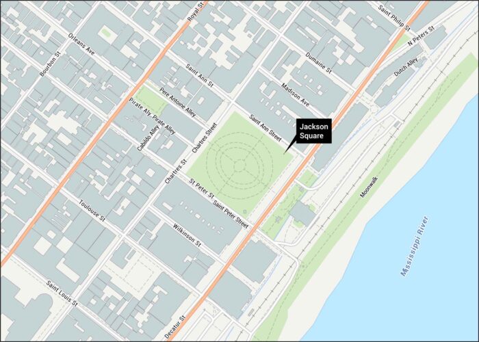
Jackson Square sits in the heart of New Orleans’ French Quarter. Our map shows the square, surrounding streets, and Mississippi River.
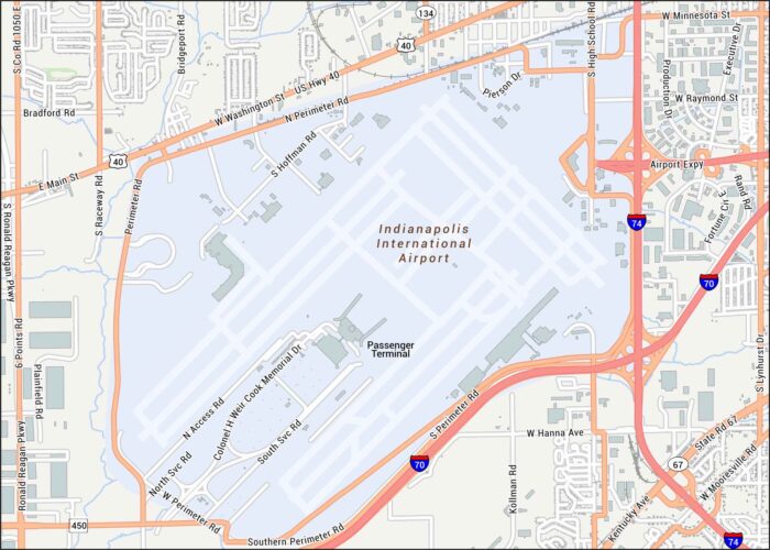
Touch down in Indianapolis. Located just west of downtown, our map shows terminals, runways, highways and much more.
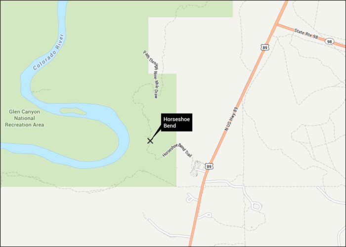
Horseshoe Bend often amazes every visitor. Located in Arizona, the Colorado River curves dramatically. Our map shows the trails and roads.
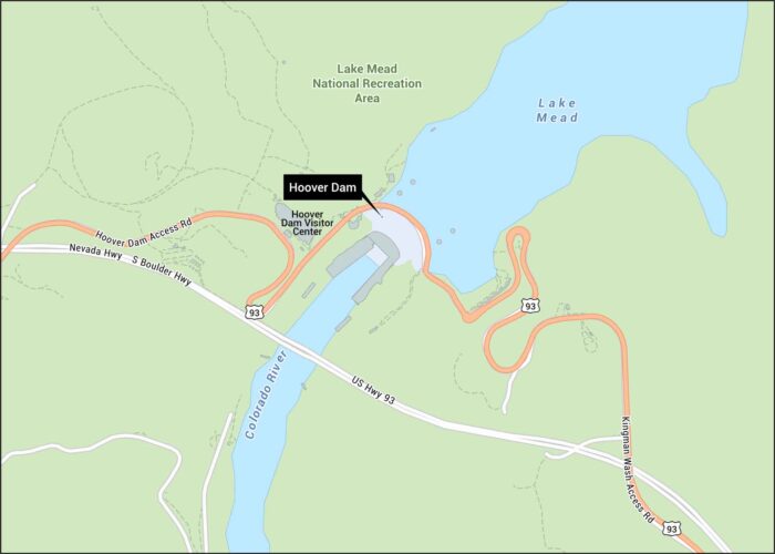
Explore the Hoover Dam with our detailed map. Located along the Colorado River, it straddles along the Nevada and Arizona border.
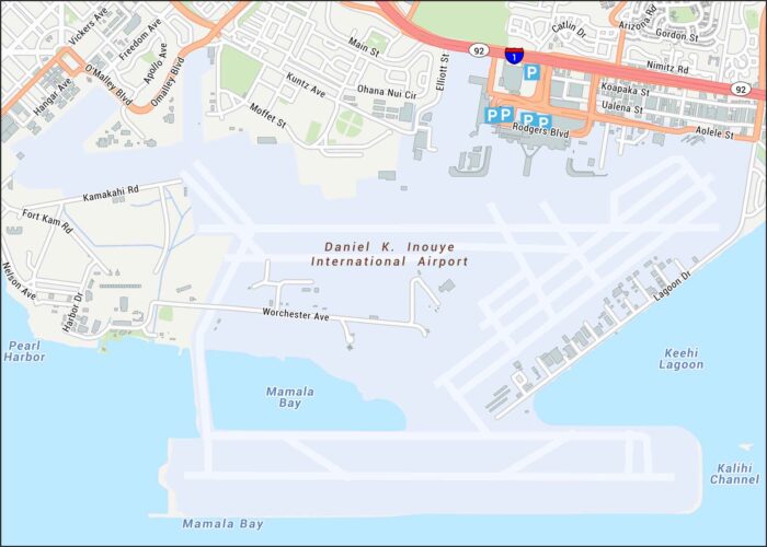
Aloha! Honolulu International Airport sits on Oahu. Our map shows terminals, runways, highways, parking, and streets.
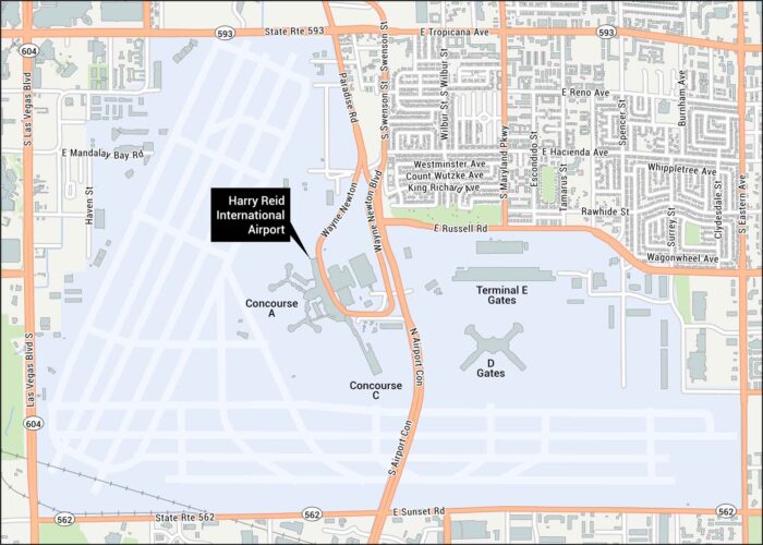
Plan your visit with our Harry Reid Airport map, which lies south of Las Vegas. Our map shows terminals, runways, highways, and streets.
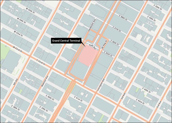
Step inside history with our Grand Central Terminal map. Our map highlights its location in in Midtown Manhattan with all of its streets.
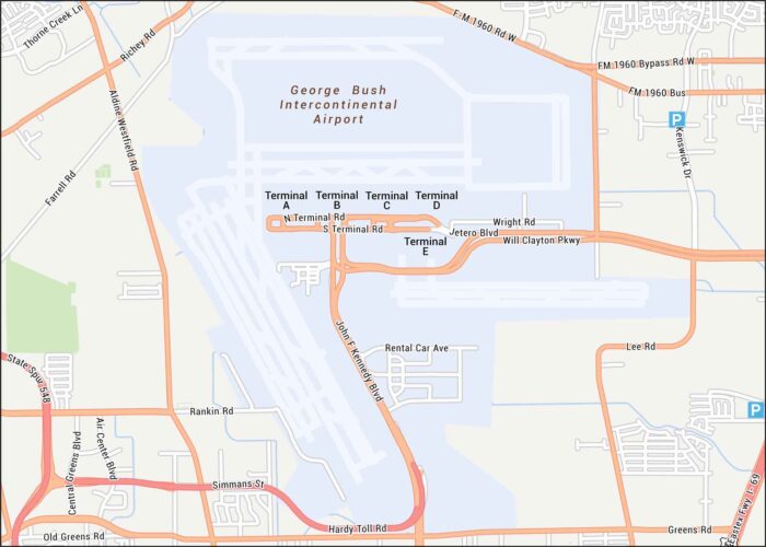
Our George Bush Airport map guides you to Houston’s busy airport. Highways, terminals, runways, and parking areas are all clearly marked.
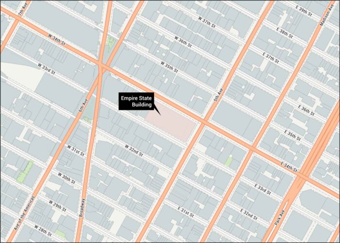
Visit the Empire. Located in Midtown Manhattan, our map shows all the nearby streets so you can get here safe and sound.