Home » Tourist Maps » Harry Reid Airport Map

Harry Reid Airport Map

Harry Reid Airport Map

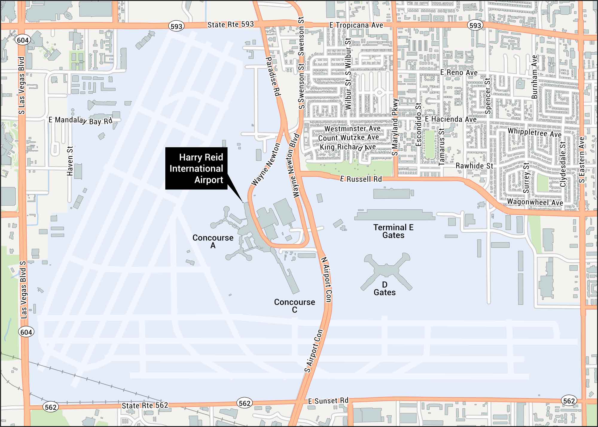
Plan your visit a bit better with our Harry Reid Airport map, which lies south of Las Vegas. Our map shows terminals, runways, highways, and streets.

Map Information

  • Harry Reid Airport, Las Vegas
  • Map of Harry Reid International Airport
  • Free for personal and commercial purpose. Attribution is required. How to attribute?

On the Map

Interstates/Highways: State Rte 593, State Rte 562 Major Roads: Tropicana Ave, Sunset Rd, Paradise Rd, Swenson St, Maryland Pkwy, Eastern Ave, Las Vegas Blvd, Wayne Newton Blvd, Russell Rd, Airport Con, Hacienda Ave, Reno Ave, Mandalay Bay Rd, Wilbur St, Haven St, Spencer St, Burnham Ave, Escondido St, Tamarus St, Rawhide St Other Landmarks: Terminal E Gates, D Gates, Concourse A, Concourse C

References

Leave a Reply

Your email address will not be published. Required fields are marked *