Jacksonville International Airport Map
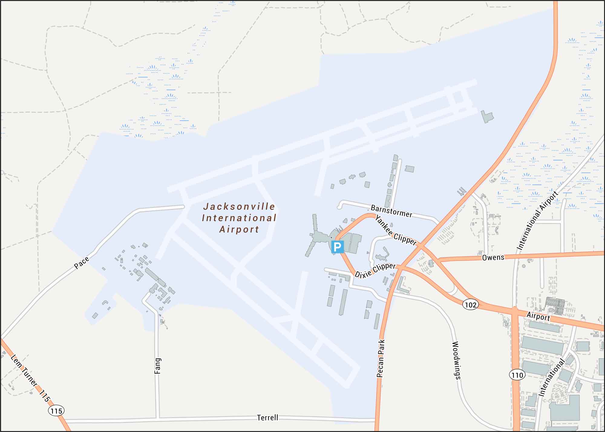
Our Jacksonville airport map allows you to fly into Jacksonville with ease. Our map highlights terminals, runways, highways, parking, and streets.
Map Information
On the Map
Interstates/Highways: I-95
Major Roads: Airport Rd, Pecan Park Rd, Lem Turner Rd, Terrell Rd, Dixie Clipper Dr, Yankee Clipper Dr, Barnstormer Rd, Woodwings Rd, Owens Rd, Pace Rd, Fang Dr
Tourist Maps in Florida
Discover all the prime locations with our tourist maps.