Idaho Precipitation Map
Check out Idaho’s split between the wet north and the dry south. Our precipitation map of Idaho reflects that strong terrain control.

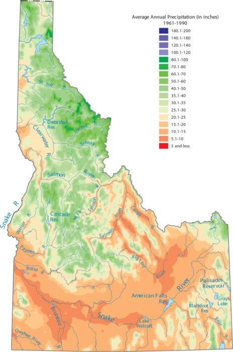
Check out Idaho’s split between the wet north and the dry south. Our precipitation map of Idaho reflects that strong terrain control.
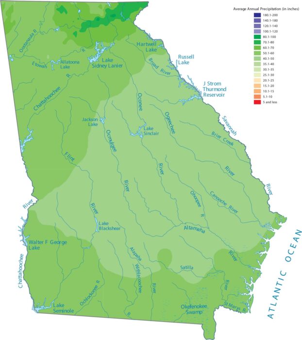
Moisture arrives here from the Gulf and Atlantic. Our precipitation map of Georgia shows how geography pulls from both directions.
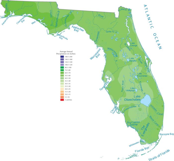
Florida’s shape guarantees tons of rain. With the Atlantic on one side and the Gulf Coast on the other, ocean moisture surrounds Florida.
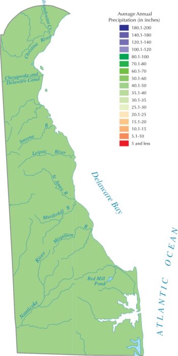
Our precipitation map of Delaware shows even rainfall across the whole state. Being between the ocean and Chesapeake Bay keeps things wet.
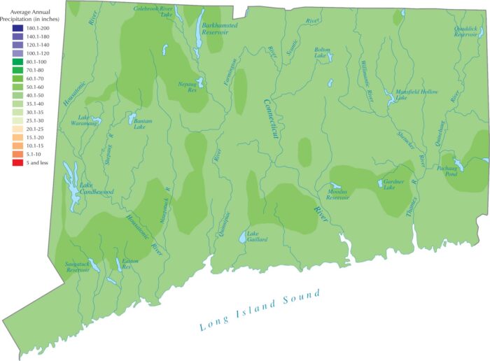
Connecticut gets steady rainfall all year because of Atlantic storm systems. Our precipitation map of Connecticut shows rainfall in the state.
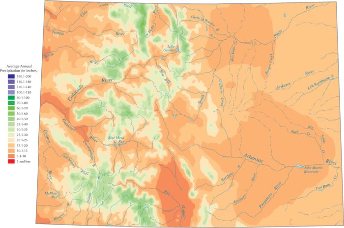
Colorado is drier overall because it sits far from oceans. Our precipitation map of Colorado shows that the highest peaks get the most water.
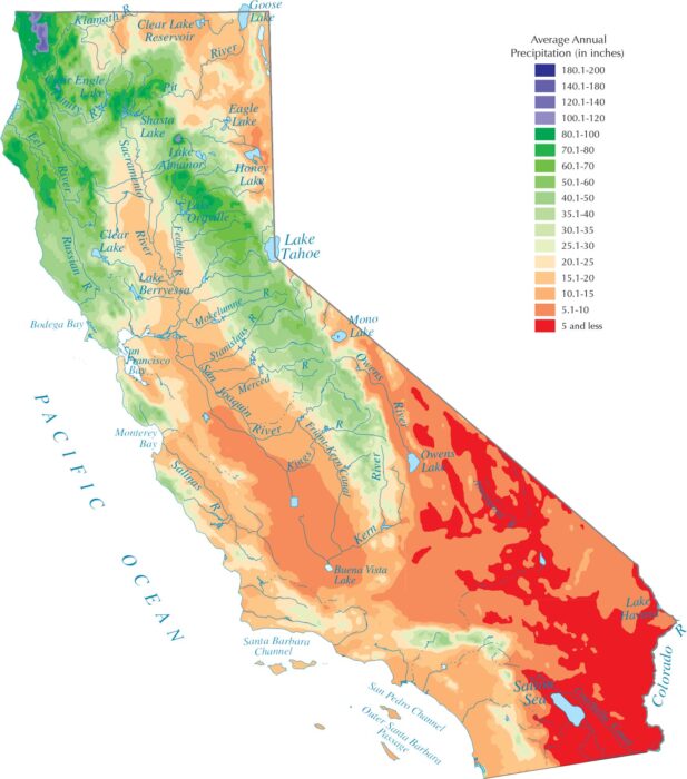
Our precipitation map of California shows a split between the rainy north and the dry south. Southern California is in a rain shadow.
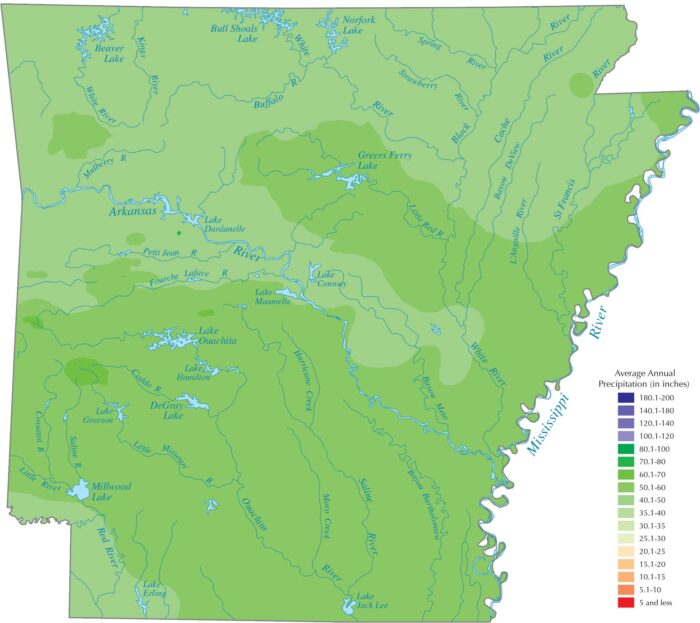
Arkansas gets steady precipitation thanks to moist air from the Gulf. Our precipitation map of Arkansas shows wetter areas in the southeast.
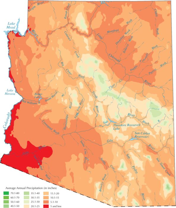
Arizona is mostly dry because of its desert geography. Our precipitation map of Arizona shows wetter areas in the mountains and Mogollon Rim.
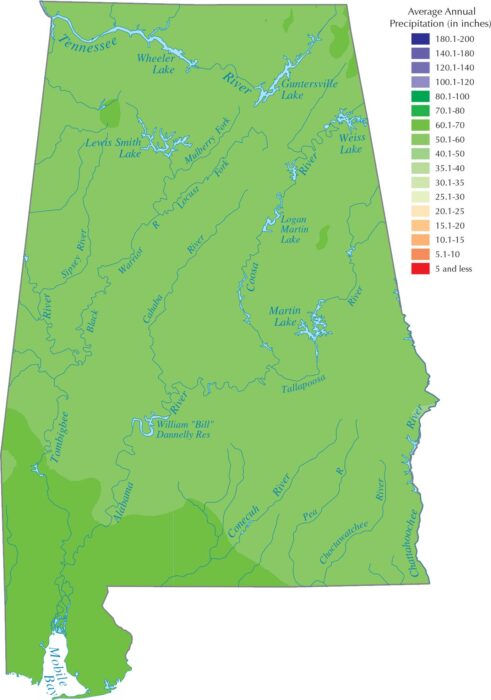
Alabama gets frequent precipitation because its Gulf Coast location. Our precipitation map of Alabama shows wetter areas in the south.
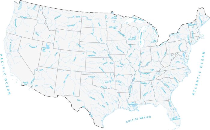
Our map of America’s lakes and rivers shows the major waterways and lakes that define the country’s landscape.
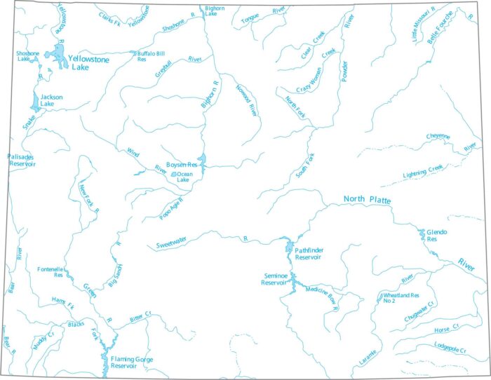
Wyoming is home to Yellowstone Lake, the largest high-elevation lake in America. Our map shows the North Platte and the Yellowstone River.
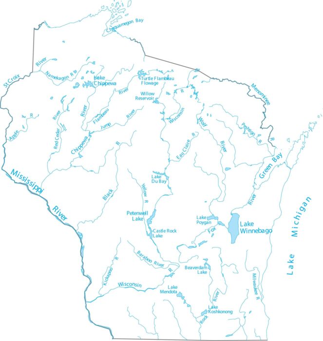
Wisconsin is in the Upper Midwest, shaped by glacial lakes and major rivers. Our map shows the Wisconsin River, which flows through.
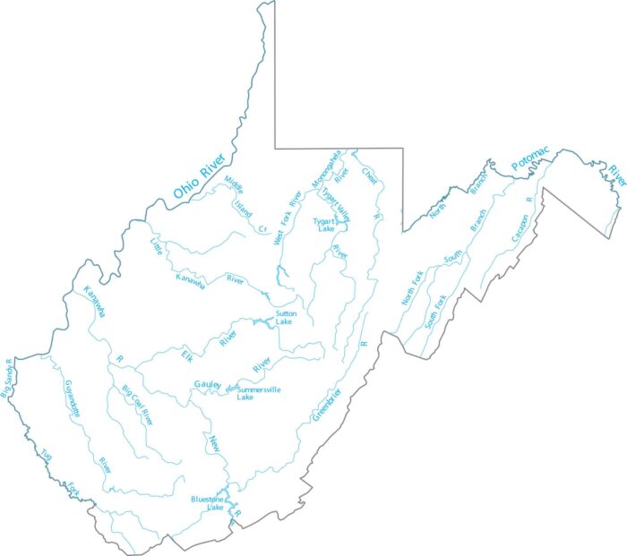
See our West Virginia waterways map. The New River, Kanawha River, and Potomac River headwaters all originate in these Appalachian highlands.
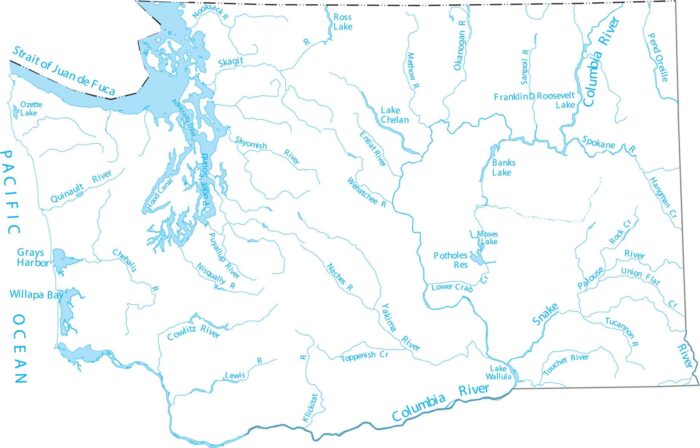
Our lakes and rivers map of Washington follows the Yakima and Columbia rivers as they cut through the Cascade Range.