Map of Madison, Wisconsin
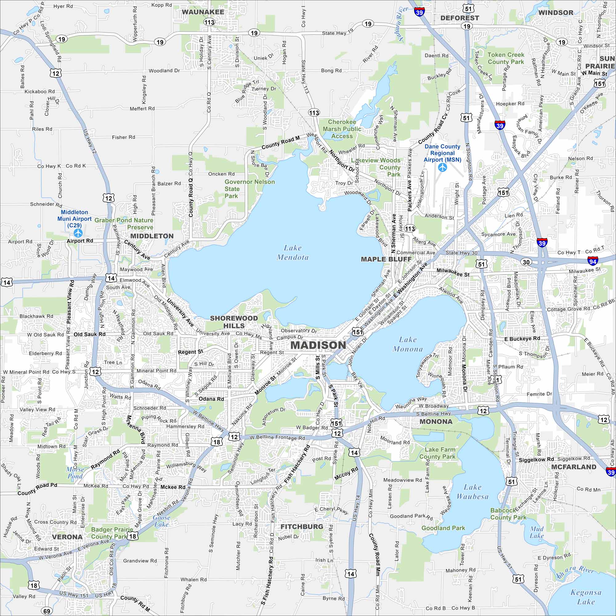
Our map of Madison highlights its setting between Lake Mendota and Lake Monona. Highways wrap around the isthmus. The state capitol stands at the center.
Map Information
On the Map
Interstates/Highways: I-39, I-90, I-94, US Hwy 12, US Hwy 14, US Hwy 51, US Hwy 151, State Rte 19, State Rte 30, State Rte 69, State Rte 113 Major Roads: Beltline Hwy, Washington Ave, Stoughton Rd, University Ave, Mineral Point Rd, Verona Rd, Gammon Rd, Packers Ave, Nakoma Rd, Johnson St, Gorham St, Monona Dr, Fish Hatchery Rd, Park St, Whitney Way, Midvale Blvd, Regent St, Odana Rd, Aberg Ave, Milwaukee St Airports: Dane County Regional Airport (MSN), Middleton Muni Airport (C29) Lakes and Reservoirs: Lake Mendota, Lake Monona, Lake Waubesa, Lake Wingra, Mud Lake, Kegonsa Lake, Goose Lake, Morse Pond Major Rivers: Yahara River Parks and Preserves: Governor Nelson State Park, Cherokee Marsh Public Access, Token Creek County Park, Lake Farm County Park, Babcock County Park, Graber Pond Nature Preserve, Badger Prairie County Park Nearby Communities: Middleton, Shorewood Hills, Monona, Fitchburg, Verona, McFarland, Sun Prairie, Waunakee, Deforest, Windsor Neighborhoods: Downtown MadisonWisconsin State Maps
Discover maps of the Badger State.


City Maps of Wisconsin
See our Wisconsin maps designed for clarity.


