Map of Los Banos, California
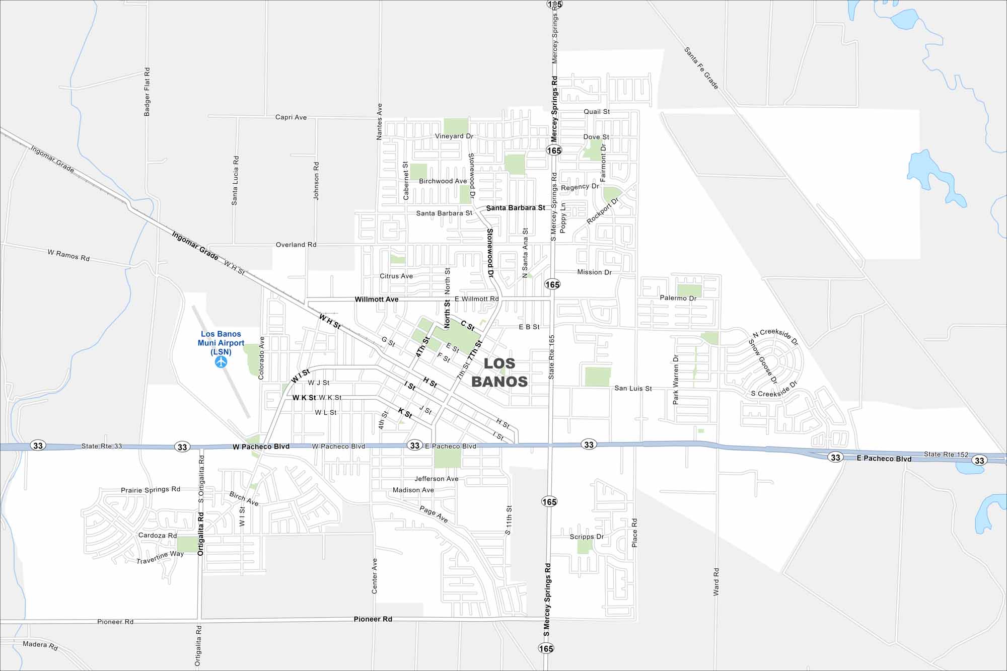
Los Banos sits in the San Joaquin Valley near wetlands and farmland. Our map shows Highway 33 (E Pacheco Blvd) cutting east-west through town. The city is mostly surrounded by open fields.
California State Maps
Explore California with our state maps


Map Information
On the Map
Interstates/Highways: State Rte 33, State Rte 152, State Rte 165 Major Roads: Pacheco Blvd, Mercey Springs Rd, Ortigalita Rd, Pioneer Rd, Willmott Ave, Santa Barbara St, Overland Rd, Ingomar Grade, Badger Flat Rd, Ward Rd, Center Ave, 4th St, 7th St, I St, H St, Page Ave, Madison Ave, Citrus Ave, Vineyard Dr, Rockport Dr Airports: Los Banos Muni Airport (LSN)California City Maps
Here are detailed maps of California


