Map of Long Branch, New Jersey
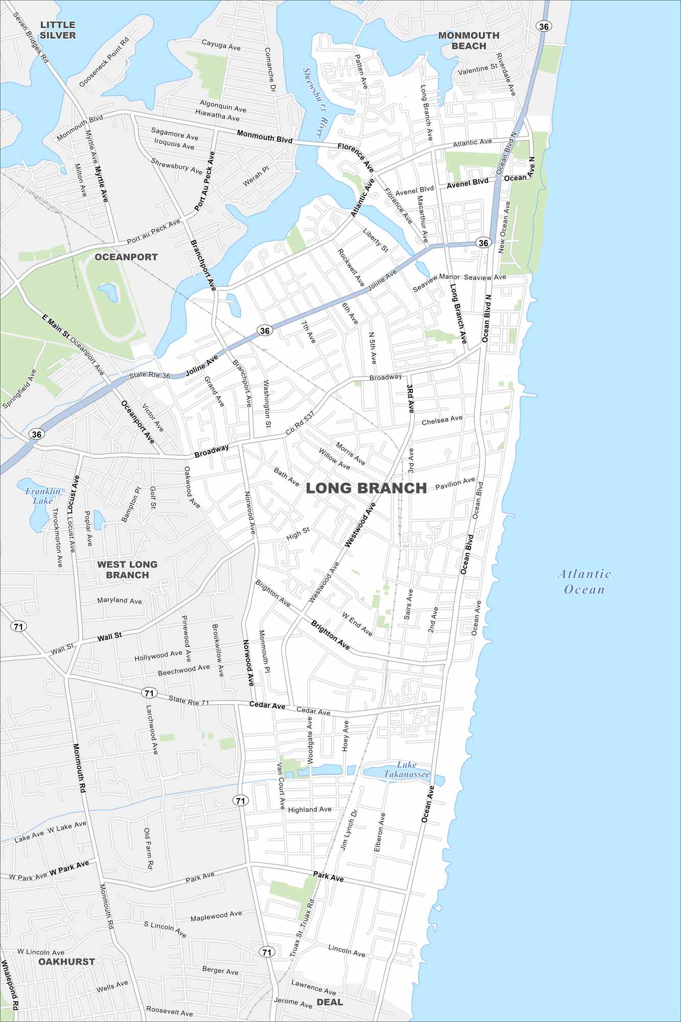
Our map of Long Branch runs along the Jersey Shore. The city fronts directly on the Atlantic. Routes connect it north to New York City.
Map Information
On the Map
Interstates/Highways: State Rte 36, State Rte 71 Major Roads: Ocean Blvd, Broadway, Joline Ave, Cedar Ave, Monmouth Blvd, Port Au Peck Ave, Norwood Ave, Wall St, Park Ave, Lincoln Ave, Seven Bridges Rd, Atlantic Ave, Avenel Blvd, Seaview Ave, Chelsea Ave, Pavilion Ave, Brighton Ave, Highland Ave, Westwood Ave, Roosevelt Ave Airports: Lakes and Reservoirs: Franklin Lake, Lake Takanassee, Atlantic Ocean Major Rivers: Shrewsbury River Nearby Communities: Little Silver, Monmouth Beach, Oceanport, West Long Branch, Oakhurst, DealNew Jersey State Maps
Explore maps from the Garden State.


City Maps of New Jersey
Newark and New Jersey cities in complete detail


