Map of Long Beach, California
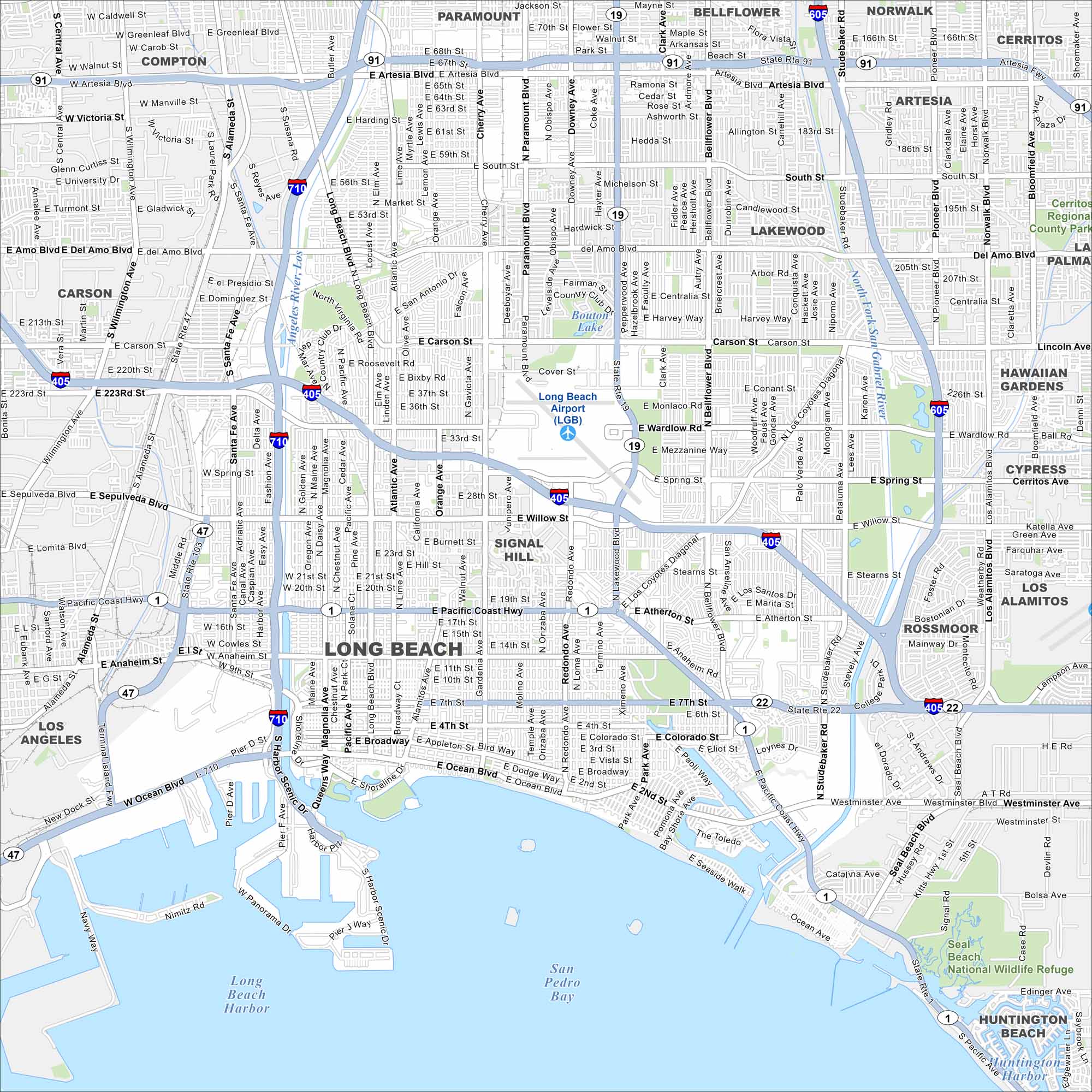
Long Beach sits on the Pacific coast south of Los Angeles. Our map shows its busy port and shoreline. Freeways tie the city to the rest of Southern California.
California State Maps
Explore California with our state maps


Map Information
On the Map
Interstates/Highways: I-405, I-710, I-605, State Rte 1, State Rte 19, State Rte 22, State Rte 47, State Rte 91, State Rte 103, Pacific Coast Hwy Major Roads: Lakewood Blvd, Bellflower Blvd, Atlantic Ave, Long Beach Blvd, Cherry Ave, Paramount Ave, Willow St, Wardlow Rd, Spring St, Artesia Blvd, Anaheim St, Ocean Blvd, Del Amo Blvd, Carson St, South St, Los Coyotes Diagonal, Studebaker Rd, Palo Verde Ave, Woodruff Ave Airports: Long Beach Airport (LGB) Lakes and Reservoirs: San Pedro Bay, Long Beach Harbor, Bouton Lake Major Rivers: Los Angeles River, San Gabriel River Parks and Preserves: Seal Beach National Wildlife Refuge, Cerritos Regional County Park Nearby Communities: Los Angeles, Carson, Compton, Paramount, Bellflower, Norwalk, Cerritos, Lakewood, Signal Hill, Rossmoor, Los Alamitos, Cypress, Hawaiian Gardens, Seal Beach, Huntington BeachCalifornia City Maps
Here are detailed maps of California


