Map of Linden, New Jersey
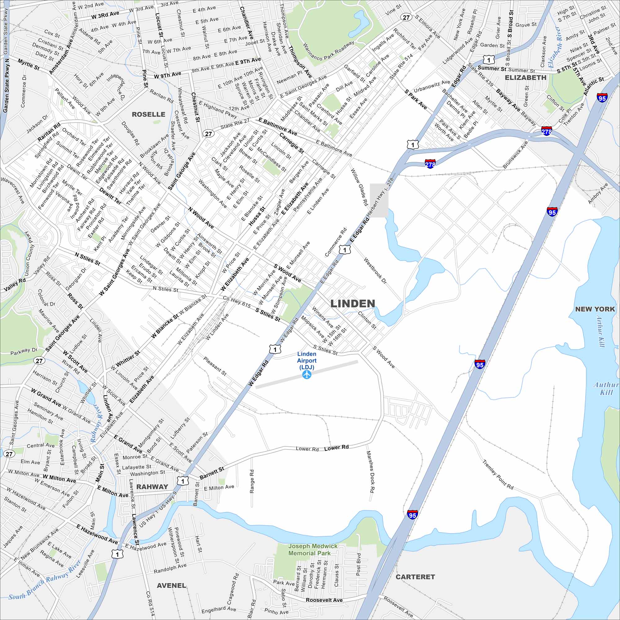
Our map of Linden highlights its mix of industry and neighborhoods. The city sits near Newark Bay with rail lines cutting across it. Refineries and shipping routes mark its landscape.
Map Information
On the Map
Interstates/Highways: I-95, I-278, US Hwy 1, US Hwy 9, State Rte 27, State Rte 439, State Rte 514, State Rte 27 Major Roads: St Georges Ave, Edgar Rd, Baltimore Ave, Wood Ave, Stiles Ave, Elizabeth Ave, Roselle St, Grand Ave, Milton Ave, Hazelwood Ave, Park Ave, Lower Rd, Marshes Dock Rd, Roosevelt Ave, Tremley Point Rd, Blancke St, Munsell Ave, Winans Ave, Clinton St, Pleasant St Airports: Linden Airport (LDJ) Major Rivers: Rahway River, Elizabeth River, South Branch Rahway River, Arthur Kill Parks and Preserves: Joseph Medwick Memorial Park Nearby Communities: Roselle, Elizabeth, Rahway, Carteret, AvenelNew Jersey State Maps
Explore maps from the Garden State.


City Maps of New Jersey
Newark and New Jersey cities in complete detail


