Map of Lancaster, California
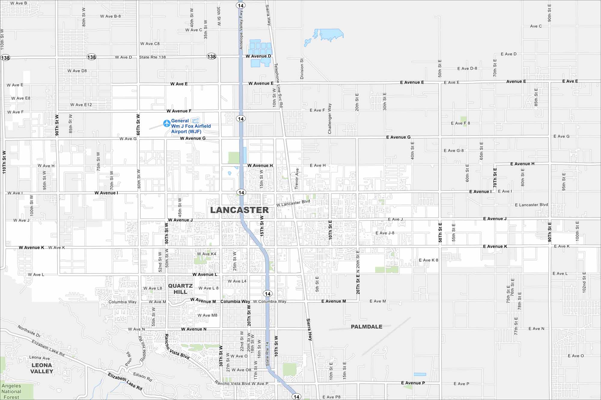
Lancaster spreads across the Antelope Valley. Wide desert streets cut a grid through the city. It’s located in the western Mojave Desert in Southern California.
California State Maps
Explore California with our state maps


Map Information
On the Map
Interstates/Highways: State Rte 14, State Rte 138 Major Roads: Lancaster Blvd, Avenue J, Avenue K, Avenue L, Avenue M, Avenue I, Avenue H, Avenue G, Avenue F, Avenue D, Avenue N, Avenue P, Sierra Hwy, Challenger Way, Division St, 10th St W, 20th St W, 30th St W, 60th St W, 90th St W Airports: Gen. Wm J Fox Airfield Airport (WJF) Parks and Preserves: Angeles National Forest Nearby Communities: Quartz Hill, Palmdale, Leona ValleyCalifornia City Maps
Here are detailed maps of California


