Map of Laguna Hills, California
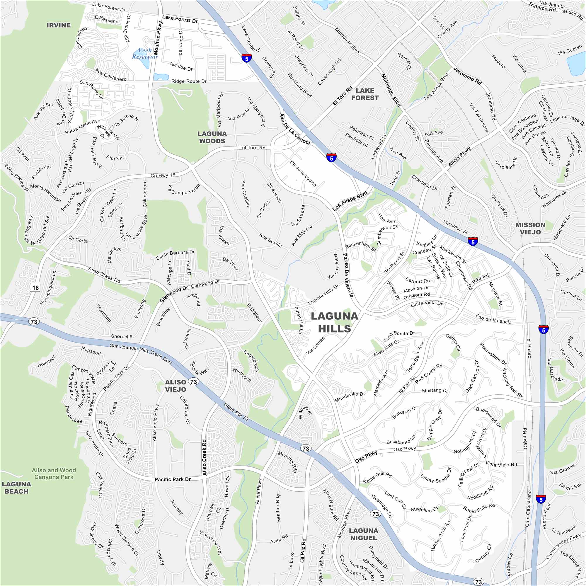
Our Laguna Hills map shows rolling hills combined with neighborhoods. Freeways frame the edges, linking it to Irvine and Mission Viejo. Parks carve out pockets of green.
California State Maps
Explore California with our state maps


Map Information
On the Map
Interstates/Highways: I-5, State Rte 73 Major Roads: El Toro Rd, Alicia Pkwy, Los Alisos Blvd, Moulton Pkwy, Paseo De Valencia, Oso Pkwy, Laguna Hills Dr, Pacific Park Dr, Aliso Creek Rd, La Paz Rd, Glenwood Dr, Cabot Rd, San Joaquin Hills Trans Corr Lakes and Reservoirs: Veeh Reservoir Parks and Preserves: Aliso and Wood Canyons Park Nearby Communities: Laguna Woods, Lake Forest, Mission Viejo, Aliso Viejo, Laguna Niguel, Laguna Beach, IrvineCalifornia City Maps
Here are detailed maps of California


